Zürich (Kreis 12) / Hirzenbach geodata
Zürich (Kreis 12) / Hirzenbach (Zurich) is a section of populated place; located in Switzerland in Europe/Zurich (GMT+2) time zone. With population of 11,335 people, there are 120 cities with bigger population in this country. Compared to other cities in Switzerland, 74.1% of cities are located further ↓South; 64.9% of cities are located further ←West and 74.4% of cities have higher elevation than Zürich (Kreis 12) / Hirzenbach. Note1
Current local time in Zürich (Kreis 12) / Hirzenbach:
08:52 AM, SaturdayDifference from your time zone: hours


Zürich (Kreis 12) / Hirzenbach GPS coordinates[2]
47° 24' 6.732" North, 8° 35' 10.788" East
| Map corner | latitude | longitude |
|---|---|---|
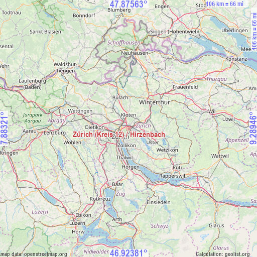
| Upper-left | 47.87563°, | 7.88321° |
| Center: | 47.40187°, | 8.58633° |
| Lower-right: | 46.92381°, | 9.28946° |
| Map W x H: | 105.8×105.8 km | = 65.7×65.7mi |
| max Lat: | 47.76737° ⇑25.9% North |
| Zürich (Kreis 12) / Hirzenbach: | 47.40187° |
| min Lat: | ⇓74.1% South 45.83203° |
| min Long | Zürich (Kreis | max Long |
| 5.97153° | 8.58633° | 10.44624° |
| W 64.9%⇐ | ⇒35.1% E |
Elevation
Elevation of Zürich (Kreis 12) / Hirzenbach is 432 m = 1417 ft, and this is 126.2 m = 414 ft below average elevation for this country.
| Max E: |
1845 m = 6053 ft | 74.4% |
| Avg. | 558.2 m = 1831 ft | |
| Zürich (Kreis 12) / Hirzenbach | 432 m = 1417 ft | |
Min E: |
197 m = 646 ft | 25.6% |
See also: Switzerland elevation on elevation.city.
Geographical zone
Zürich (Kreis 12) / Hirzenbach is located in North temperate zone (between Tropic of Cancer and the Arctic Circle). Distance of this North polar circle is 2130.6 km =1323.9 mi to North.| Distance of | km | miles | from Zürich (Kreis 12) / Hirzenbach |
|---|---|---|---|
| North Pole | 4736.5 | 2943.1 | to North |
| Arctic Circle | 2130.6 | 1323.9 | to North |
| Tropic Cancer | 2664.7 | 1655.8 | to South |
| Equator | 5270.6 | 3275 | to South |


Nearby cities:
15 places around Zürich (Kreis 12) / Hirzenbach: (largest is in red/bold)
• Dübendorf / Birchlen
1.8 km =1.1 mi,  101°
101°
• Dübendorf / Heugatterstrasse
1.9 km =1.2 mi,  107°
107°
• Dübendorf / Meiershofstrasse
2.2 km =1.4 mi, 100°
• Dübendorf / Vogelquartier
2.1 km =1.3 mi, 111°
• Dübendorf / Wasserfurren
1.9 km =1.2 mi,  119°
119°
• Gockhausen / Meisenrain
2.1 km =1.3 mi,  159°
159°
• Wallisellen
1.7 km =1.1 mi,  28°
28°
• Wallisellen / Hof
1.5 km =0.9 mi,  58°
58°
• Wallisellen / Rieden
2 km =1.2 mi, 31°
• Wallisellen / Wallisellen-Ost
1.6 km =1 mi, 30°
• Wallisellen / Wallisellen-West
1.9 km =1.2 mi,  358°
358°
• Zürich (Kreis 12)
0.8 km =0.5 mi,  284°
284°
• Zürich (Kreis 12) / Auzelg
1.9 km =1.2 mi,  320°
320°
• Zürich (Kreis 12) / Saatlen
1.9 km =1.2 mi,  302°
302°
• Zürich (Kreis 12) / Schwamendingen-Mitte
1.2 km =0.7 mi, 295°
Sources, notices
• [Note1] Compared only with cities in Switzerland existing in our database
• [Src1] Map data: © OpenStreetMap contributors (CC-BY-SA)
• [Src2] Other city data from geonames.org with taken over terms of usage.
• [Src3] Geographical zone / Annual Mean Temperature by Robert A. Rohde @ Wikipedia
