Dietlikon / Eichwiesen geodata
Dietlikon / Eichwiesen (Zurich) is a section of populated place; located in Switzerland in Europe/Zurich (GMT+2) time zone. With population of 1,386 people, there are 1093 cities with bigger population in this country. Compared to other cities in Switzerland, 77.6% of cities are located further ↓South; 68.3% of cities are located further ←West and 70.2% of cities have higher elevation than Dietlikon / Eichwiesen. Note1
Current local time in Dietlikon / Eichwiesen:
08:51 AM, SaturdayDifference from your time zone: hours


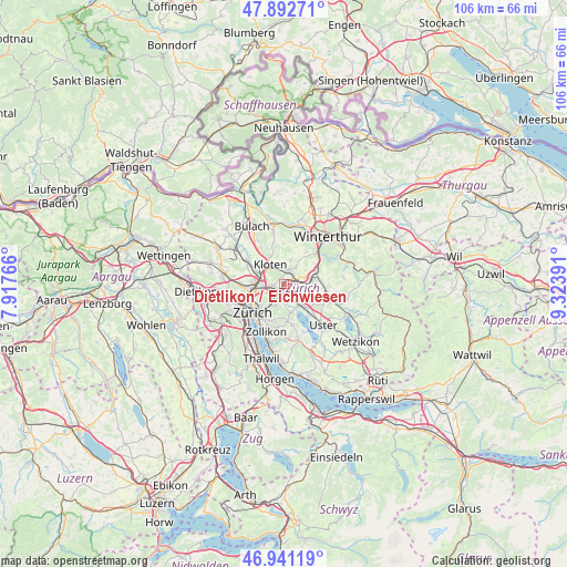
Dietlikon / Eichwiesen GPS coordinates[2]
47° 25' 8.76" North, 8° 37' 14.808" East
| Map corner | latitude | longitude |
|---|---|---|
| Upper-left | 47.89271°, | 7.91766° |
| Center: | 47.4191°, | 8.62078° |
| Lower-right: | 46.94119°, | 9.32391° |
| Map W x H: | 105.8×105.8 km | = 65.7×65.7mi |
| max Lat: | 47.76737° ⇑22.4% North |
| Dietlikon / Eichwiesen: | 47.4191° |
| min Lat: | ⇓77.6% South 45.83203° |
| min Long | Dietlikon / Eic | max Long |
| 5.97153° | 8.62078° | 10.44624° |
| W 68.3%⇐ | ⇒31.7% E |
Elevation
Elevation of Dietlikon / Eichwiesen is 439 m = 1440 ft, and this is 119.2 m = 391 ft below average elevation for this country.
| Max E: |
1845 m = 6053 ft | 70.2% |
| Avg. | 558.2 m = 1831 ft | |
| Dietlikon / Eichwiesen | 439 m = 1440 ft | |
Min E: |
197 m = 646 ft | 29.8% |
See also: Switzerland elevation on elevation.city.
Geographical zone
Dietlikon / Eichwiesen is located in North temperate zone (between Tropic of Cancer and the Arctic Circle). Distance of this North polar circle is 2128.7 km =1322.7 mi to North.| Distance of | km | miles | from Dietlikon / Eichwiesen |
|---|---|---|---|
| North Pole | 4734.6 | 2941.9 | to North |
| Arctic Circle | 2128.7 | 1322.7 | to North |
| Tropic Cancer | 2666.6 | 1656.9 | to South |
| Equator | 5272.5 | 3276.2 | to South |


Nearby cities:
15 places around Dietlikon / Eichwiesen: (largest is in red/bold)
• Brüttisellen
0.9 km =0.6 mi,  71°
71°
• Dietlikon / Dietlikon (Dorf)
0.2 km =0.1 mi,  238°
238°
• Dübendorf
2.4 km =1.5 mi,  183°
183°
• Dübendorf / Birchlen
2.4 km =1.5 mi,  200°
200°
• Dübendorf / Eglishölzli
1.5 km =0.9 mi,  158°
158°
• Dübendorf / Im Zwinggarten
1.6 km =1 mi,  192°
192°
• Dübendorf / Kunklerstrasse
2.1 km =1.3 mi,  166°
166°
• Dübendorf / Meiershofstrasse
2.4 km =1.5 mi, 191°
• Dübendorf / Neuhausstrasse
2.6 km =1.6 mi, 180°
• Dübendorf / Stägenbuck
1.9 km =1.2 mi, 175°
• Wallisellen
1.9 km =1.2 mi,  255°
255°
• Wallisellen / Hof
1.7 km =1.1 mi,  229°
229°
• Wallisellen / Rieden
1.6 km =1 mi, 262°
• Wallisellen / Wallisellen-Ost
1.8 km =1.1 mi,  253°
253°
• Wangen
2 km =1.2 mi,  113°
113°
Sources, notices
• [Note1] Compared only with cities in Switzerland existing in our database
• [Src1] Map data: © OpenStreetMap contributors (CC-BY-SA)
• [Src2] Other city data from geonames.org with taken over terms of usage.
• [Src3] Geographical zone / Annual Mean Temperature by Robert A. Rohde @ Wikipedia
