Riedt geodata
Riedt (Zurich) is a populated place; located in Switzerland in Europe/Zurich (GMT+2) time zone. With population of 811 people, there are 1485 cities with bigger population in this country. Compared to other cities in Switzerland, 89.3% of cities are located further ↓South; 55.2% of cities are located further ←West and 73.6% of cities have higher elevation than Riedt. Note1


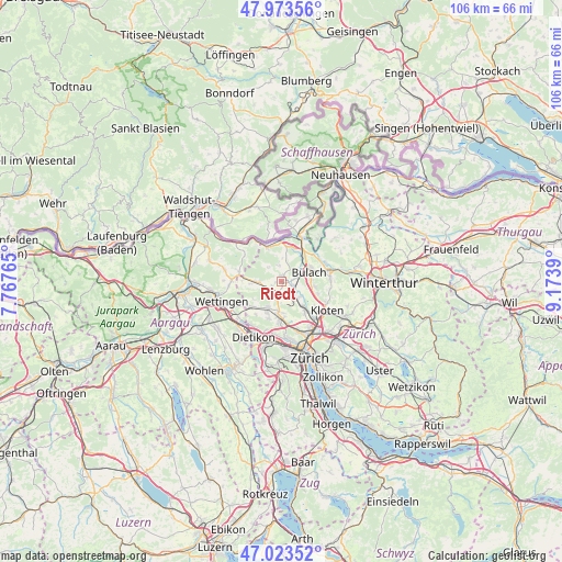
Riedt GPS coordinates[2]
47° 30' 2.484" North, 8° 28' 14.808" East
| Map corner | latitude | longitude |
|---|---|---|
| Upper-left | 47.97356°, | 7.76765° |
| Center: | 47.50069°, | 8.47078° |
| Lower-right: | 47.02352°, | 9.1739° |
| Map W x H: | 105.6×105.6 km | = 65.6×65.6mi |
| max Lat: | 47.76737° ⇑10.7% North |
| Riedt: | 47.50069° |
| min Lat: | ⇓89.3% South 45.83203° |
| min Long | Riedt | max Long |
| 5.97153° | 8.47078° | 10.44624° |
| W 55.2%⇐ | ⇒44.8% E |
Elevation
Elevation of Riedt is 434 m = 1424 ft, and this is 124.2 m = 407 ft below average elevation for this country.
| Max E: |
1845 m = 6053 ft | 73.6% |
| Avg. | 558.2 m = 1831 ft | |
| Riedt | 434 m = 1424 ft | |
Min E: |
197 m = 646 ft | 26.4% |
See also: Switzerland elevation on elevation.city.
Geographical zone
Riedt is located in North temperate zone (between Tropic of Cancer and the Arctic Circle). Distance of this North polar circle is 2119.6 km =1317.1 mi to North.| Distance of | km | miles | from Riedt |
|---|---|---|---|
| North Pole | 4725.5 | 2936.3 | to North |
| Arctic Circle | 2119.6 | 1317.1 | to North |
| Tropic Cancer | 2675.7 | 1662.6 | to South |
| Equator | 5281.6 | 3281.8 | to South |


Nearby cities:
15 places around Riedt: (largest is in red/bold)
• Bückler-Dörnler
3.5 km =2.2 mi,  76°
76°
• Dielsdorf
2.3 km =1.4 mi,  203°
203°
• Hofstetten
3.7 km =2.3 mi,  133°
133°
• Höri
3.2 km =2 mi, 75°
• Neerach
1.1 km =0.7 mi,  0°
0°
• Niederglatt
2.5 km =1.6 mi,  117°
117°
• Niederglatt / Grafschaft
2.5 km =1.6 mi,  106°
106°
• Niederglatt / Niederglatt (Dorfkern)
2.5 km =1.6 mi, 116°
• Niederglatt / Nöschikon
1.9 km =1.2 mi, 108°
• Niederhasli
2.5 km =1.6 mi,  153°
153°
• Ober-Höri
2 km =1.2 mi, 79°
• Schibler
2.1 km =1.3 mi,  226°
226°
• Stadel
3.2 km =2 mi,  350°
350°
• Steinmaur
1.5 km =0.9 mi,  254°
254°
• Steinmaur / Nieder-Steinmaur
1.9 km =1.2 mi,  242°
242°
Sources, notices
• [Note1] Compared only with cities in Switzerland existing in our database
• [Src1] Map data: © OpenStreetMap contributors (CC-BY-SA)
• [Src2] Other city data from geonames.org with taken over terms of usage.
• [Src3] Geographical zone / Annual Mean Temperature by Robert A. Rohde @ Wikipedia
