Rüti / Dorfzentrum, Südl. Teil geodata
Rüti / Dorfzentrum, Südl. Teil (Zurich) is a section of populated place; located in Switzerland in Europe/Zurich (GMT+2) time zone. With population of 3,618 people, there are 494 cities with bigger population in this country. Compared to other cities in Switzerland, 52% of cities are located further ↓South; 83.5% of cities are located further ←West and 54.2% of cities have higher elevation than Rüti / Dorfzentrum, Südl. Teil. Note1
Current local time in Rüti / Dorfzentrum, Südl. Teil:
07:35 AM, SaturdayDifference from your time zone: hours


Rüti / Dorfzentrum, Südl. Teil GPS coordinates[2]
47° 15' 13.248" North, 8° 51' 23.544" East
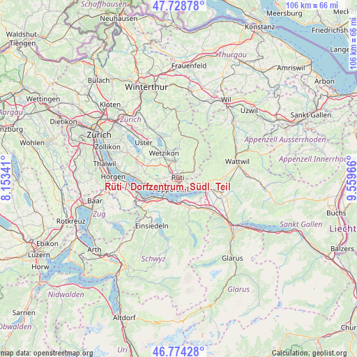
| Map corner | latitude | longitude |
|---|---|---|
| Upper-left | 47.72878°, | 8.15341° |
| Center: | 47.25368°, | 8.85654° |
| Lower-right: | 46.77428°, | 9.55966° |
| Map W x H: | 106.1×106.1 km | = 65.9×65.9mi |
| max Lat: | 47.76737° ⇑48% North |
| Rüti / Dorfzentrum, Südl. Teil: | 47.25368° |
| min Lat: | ⇓52% South 45.83203° |
| min Long | Rüti / Dorfzen | max Long |
| 5.97153° | 8.85654° | 10.44624° |
| W 83.5%⇐ | ⇒16.5% E |
Elevation
Elevation of Rüti / Dorfzentrum, Südl. Teil is 469 m = 1539 ft, and this is 89.2 m = 293 ft below average elevation for this country.
| Max E: |
1845 m = 6053 ft | 54.2% |
| Avg. | 558.2 m = 1831 ft | |
| Rüti / Dorfzentrum, Südl. Teil | 469 m = 1539 ft | |
Min E: |
197 m = 646 ft | 45.8% |
See also: Switzerland elevation on elevation.city.
Geographical zone
Rüti / Dorfzentrum, Südl. Teil is located in North temperate zone (between Tropic of Cancer and the Arctic Circle). Distance of this North polar circle is 2147.1 km =1334.1 mi to North.| Distance of | km | miles | from Rüti / Dorfzentrum, Südl. Teil |
|---|---|---|---|
| North Pole | 4752.9 | 2953.3 | to North |
| Arctic Circle | 2147.1 | 1334.1 | to North |
| Tropic Cancer | 2648.2 | 1645.5 | to South |
| Equator | 5254.1 | 3264.7 | to South |


Nearby cities:
15 places around Rüti / Dorfzentrum, Südl. Teil: (largest is in red/bold)
• Breitenmatt
2.9 km =1.8 mi,  28°
28°
• Bubikon
3.3 km =2.1 mi,  296°
296°
• Bubikon / Station
3.3 km =2.1 mi,  306°
306°
• Dürnten
3 km =1.9 mi,  337°
337°
• Hadlikon
3.8 km =2.4 mi,  0°
0°
• Jona
3 km =1.9 mi,  206°
206°
• Oberdürnten
2.9 km =1.8 mi,  7°
7°
• Pilgerhof
1.6 km =1 mi, 29°
• Rapperswil
4.1 km =2.5 mi,  219°
219°
• Rüti
0.3 km =0.2 mi, 343°
• Rüti / Oberdorf
0.9 km =0.6 mi,  47°
47°
• Rüti / Westlicher Dorfteil
0.9 km =0.6 mi,  282°
282°
• Tann
1.8 km =1.1 mi, 344°
• Tann / Tann (Dorfkern)
1.3 km =0.8 mi, 339°
• Wolfhausen
4.3 km =2.7 mi,  273°
273°
Sources, notices
• [Note1] Compared only with cities in Switzerland existing in our database
• [Src1] Map data: © OpenStreetMap contributors (CC-BY-SA)
• [Src2] Other city data from geonames.org with taken over terms of usage.
• [Src3] Geographical zone / Annual Mean Temperature by Robert A. Rohde @ Wikipedia
