Zürich (Kreis 2) / Unter-Leimbach geodata
Zürich (Kreis 2) / Unter-Leimbach (Zurich) is a section of populated place; located in Switzerland in Europe/Zurich (GMT+2) time zone. With population of 2,778 people, there are 637 cities with bigger population in this country. Compared to other cities in Switzerland, 62.8% of cities are located further ↓South; 57.7% of cities are located further ←West and 50.3% of cities have higher elevation than Zürich (Kreis 2) / Unter-Leimbach. Note1
Current local time in Zürich (Kreis 2) / Unter-Leimbach:
08:58 AM, SaturdayDifference from your time zone: hours


Zürich (Kreis 2) / Unter-Leimbach GPS coordinates[2]
47° 20' 1.032" North, 8° 30' 51.588" East
| Map corner | latitude | longitude |
|---|---|---|
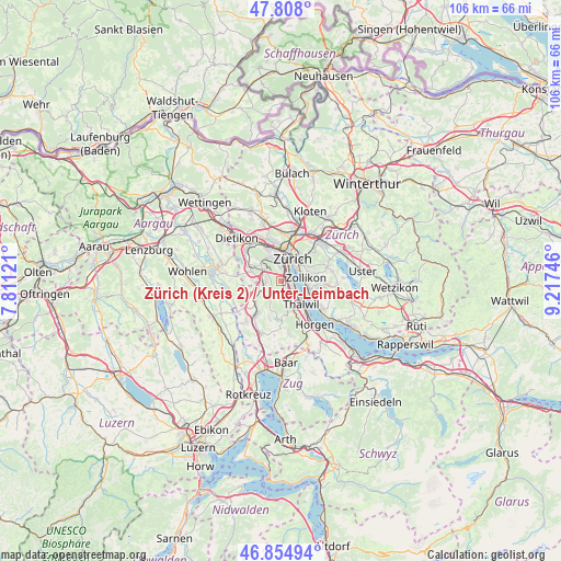
| Upper-left | 47.808°, | 7.81121° |
| Center: | 47.33362°, | 8.51433° |
| Lower-right: | 46.85494°, | 9.21746° |
| Map W x H: | 106×106 km | = 65.9×65.9mi |
| max Lat: | 47.76737° ⇑37.2% North |
| Zürich (Kreis 2) / Unter-Leimbach: | 47.33362° |
| min Lat: | ⇓62.8% South 45.83203° |
| min Long | Zürich (Kreis | max Long |
| 5.97153° | 8.51433° | 10.44624° |
| W 57.7%⇐ | ⇒42.3% E |
Elevation
Elevation of Zürich (Kreis 2) / Unter-Leimbach is 477 m = 1565 ft, and this is 81.2 m = 266 ft below average elevation for this country.
| Max E: |
1845 m = 6053 ft | 50.3% |
| Avg. | 558.2 m = 1831 ft | |
| Zürich (Kreis 2) / Unter-Leimbach | 477 m = 1565 ft | |
Min E: |
197 m = 646 ft | 49.7% |
See also: Switzerland elevation on elevation.city.
Geographical zone
Zürich (Kreis 2) / Unter-Leimbach is located in North temperate zone (between Tropic of Cancer and the Arctic Circle). Distance of this North polar circle is 2138.2 km =1328.6 mi to North.| Distance of | km | miles | from Zürich (Kreis 2) / Unter-Leimbach |
|---|---|---|---|
| North Pole | 4744.1 | 2947.8 | to North |
| Arctic Circle | 2138.2 | 1328.6 | to North |
| Tropic Cancer | 2657.1 | 1651 | to South |
| Equator | 5263 | 3270.3 | to South |


Nearby cities:
15 places around Zürich (Kreis 2) / Unter-Leimbach: (largest is in red/bold)
• Adliswil
2.7 km =1.7 mi,  163°
163°
• Adliswil / Adliswil (Stadtkern)
2.7 km =1.7 mi, 159°
• Adliswil / Hündli-Zopf
1.9 km =1.2 mi,  169°
169°
• Adliswil / Lebern
2.5 km =1.6 mi,  144°
144°
• Adliswil / Oberleimbach
1.5 km =0.9 mi,  177°
177°
• Adliswil / Sihlhof
1.4 km =0.9 mi, 156°
• Adliswil / Sood
1.8 km =1.1 mi, 155°
• Kilchberg
2.6 km =1.6 mi,  113°
113°
• Kilchberg / Bächler-Stocken
2 km =1.2 mi, 110°
• Kilchberg / Hornhalden
2.1 km =1.3 mi,  97°
97°
• Kilchberg / Kilchberg (Dorfkern)
2.6 km =1.6 mi,  124°
124°
• Sellenbüren
2.6 km =1.6 mi,  295°
295°
• Zürich (Kreis 2)
0.7 km =0.4 mi,  49°
49°
• Zürich (Kreis 2) / Mittel-Leimbach
0.9 km =0.6 mi, 181°
• Zürich (Kreis 2) / Wollishofen
1.5 km =0.9 mi,  60°
60°
Sources, notices
• [Note1] Compared only with cities in Switzerland existing in our database
• [Src1] Map data: © OpenStreetMap contributors (CC-BY-SA)
• [Src2] Other city data from geonames.org with taken over terms of usage.
• [Src3] Geographical zone / Annual Mean Temperature by Robert A. Rohde @ Wikipedia
