Töss (Kreis 4) / Schlosstal geodata
Töss (Kreis 4) / Schlosstal (Zurich) is a section of populated place; located in Switzerland in Europe/Zurich (GMT+2) time zone. With population of 2,762 people, there are 641 cities with bigger population in this country. Compared to other cities in Switzerland, 87.8% of cities are located further ↓South; 74.6% of cities are located further ←West and 74.4% of cities have higher elevation than Töss (Kreis 4) / Schlosstal. Note1
Current local time in Töss (Kreis 4) / Schlosstal:
08:14 AM, SaturdayDifference from your time zone: hours


Töss (Kreis 4) / Schlosstal GPS coordinates[2]
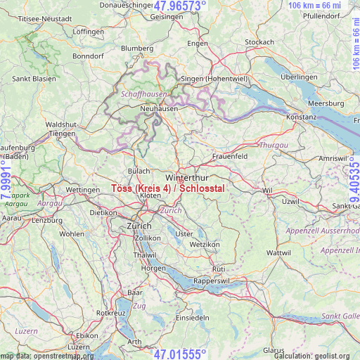
47° 29' 34.044" North, 8° 42' 8.028" East
| Map corner | latitude | longitude |
|---|---|---|
| Upper-left | 47.96573°, | 7.9991° |
| Center: | 47.49279°, | 8.70223° |
| Lower-right: | 47.01555°, | 9.40535° |
| Map W x H: | 105.7×105.6 km | = 65.7×65.6mi |
| max Lat: | 47.76737° ⇑12.2% North |
| Töss (Kreis 4) / Schlosstal: | 47.49279° |
| min Lat: | ⇓87.8% South 45.83203° |
| min Long | Töss (Kreis 4) | max Long |
| 5.97153° | 8.70223° | 10.44624° |
| W 74.6%⇐ | ⇒25.4% E |
Elevation
Elevation of Töss (Kreis 4) / Schlosstal is 432 m = 1417 ft, and this is 126.2 m = 414 ft below average elevation for this country.
| Max E: |
1845 m = 6053 ft | 74.4% |
| Avg. | 558.2 m = 1831 ft | |
| Töss (Kreis 4) / Schlosstal | 432 m = 1417 ft | |
Min E: |
197 m = 646 ft | 25.6% |
See also: Switzerland elevation on elevation.city.
Geographical zone
Töss (Kreis 4) / Schlosstal is located in North temperate zone (between Tropic of Cancer and the Arctic Circle). Distance of this North polar circle is 2120.5 km =1317.6 mi to North.| Distance of | km | miles | from Töss (Kreis 4) / Schlosstal |
|---|---|---|---|
| North Pole | 4726.4 | 2936.8 | to North |
| Arctic Circle | 2120.5 | 1317.6 | to North |
| Tropic Cancer | 2674.8 | 1662 | to South |
| Equator | 5280.7 | 3281.3 | to South |


Nearby cities:
15 places around Töss (Kreis 4) / Schlosstal: (largest is in red/bold)
• Stadt Winterthur (Kreis 1)
1.3 km =0.8 mi,  79°
79°
• Stadt Winterthur (Kreis 1) / Altstadt
2.1 km =1.3 mi,  69°
69°
• Stadt Winterthur (Kreis 1) / Brühlberg
1 km =0.6 mi,  55°
55°
• Stadt Winterthur (Kreis 1) / Heiligberg
1.6 km =1 mi, 84°
• Stadt Winterthur (Kreis 1) / Neuwiesen
1.5 km =0.9 mi,  45°
45°
• Stadt Winterthur (Kreis 1) / Tössfeld
1 km =0.6 mi,  85°
85°
• Töss (Kreis 4)
1.5 km =0.9 mi,  180°
180°
• Töss (Kreis 4) / Eichliacker
0.7 km =0.4 mi,  147°
147°
• Töss (Kreis 4) / Steig
2.1 km =1.3 mi, 180°
• Töss (Kreis 4) / Vorder-Dättnau
1.3 km =0.8 mi,  192°
192°
• Veltheim (Kreis 5) / Blumenau
1.8 km =1.1 mi,  34°
34°
• Winterthur
2.2 km =1.4 mi, 49°
• Wülflingen (Kreis 6) / Lindenplatz
2.1 km =1.3 mi,  340°
340°
• Wülflingen (Kreis 6) / Oberfeld
0.7 km =0.4 mi, 339°
• Wülflingen (Kreis 6) / Weinberg
2 km =1.2 mi,  356°
356°
Sources, notices
• [Note1] Compared only with cities in Switzerland existing in our database
• [Src1] Map data: © OpenStreetMap contributors (CC-BY-SA)
• [Src2] Other city data from geonames.org with taken over terms of usage.
• [Src3] Geographical zone / Annual Mean Temperature by Robert A. Rohde @ Wikipedia
