Wülflingen (Kreis 6) / Oberfeld geodata
Wülflingen (Kreis 6) / Oberfeld (Zurich) is a section of populated place; located in Switzerland in Europe/Zurich (GMT+2) time zone. With population of 4,288 people, there are 404 cities with bigger population in this country. Compared to other cities in Switzerland, 88.9% of cities are located further ↓South; 74.2% of cities are located further ←West and 60.3% of cities have higher elevation than Wülflingen (Kreis 6) / Oberfeld. Note1
Current local time in Wülflingen (Kreis 6) / Oberfeld:
07:41 AM, SaturdayDifference from your time zone: hours


Wülflingen (Kreis 6) / Oberfeld GPS coordinates[2]
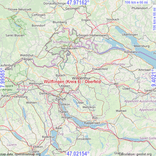
47° 29' 55.428" North, 8° 41' 56.292" East
| Map corner | latitude | longitude |
|---|---|---|
| Upper-left | 47.97162°, | 7.99585° |
| Center: | 47.49873°, | 8.69897° |
| Lower-right: | 47.02154°, | 9.4021° |
| Map W x H: | 105.6×105.6 km | = 65.6×65.6mi |
| max Lat: | 47.76737° ⇑11.1% North |
| Wülflingen (Kreis 6) / Oberfeld: | 47.49873° |
| min Lat: | ⇓88.9% South 45.83203° |
| min Long | Wülflingen (Kr | max Long |
| 5.97153° | 8.69897° | 10.44624° |
| W 74.2%⇐ | ⇒25.8% E |
Elevation
Elevation of Wülflingen (Kreis 6) / Oberfeld is 454 m = 1490 ft, and this is 104.2 m = 342 ft below average elevation for this country.
| Max E: |
1845 m = 6053 ft | 60.3% |
| Avg. | 558.2 m = 1831 ft | |
| Wülflingen (Kreis 6) / Oberfeld | 454 m = 1490 ft | |
Min E: |
197 m = 646 ft | 39.7% |
See also: Switzerland elevation on elevation.city.
Geographical zone
Wülflingen (Kreis 6) / Oberfeld is located in North temperate zone (between Tropic of Cancer and the Arctic Circle). Distance of this North polar circle is 2119.8 km =1317.2 mi to North.| Distance of | km | miles | from Wülflingen (Kreis 6) / Oberfeld |
|---|---|---|---|
| North Pole | 4725.7 | 2936.4 | to North |
| Arctic Circle | 2119.8 | 1317.2 | to North |
| Tropic Cancer | 2675.4 | 1662.4 | to South |
| Equator | 5281.4 | 3281.7 | to South |


Nearby cities:
15 places around Wülflingen (Kreis 6) / Oberfeld: (largest is in red/bold)
• Stadt Winterthur (Kreis 1)
1.6 km =1 mi,  105°
105°
• Stadt Winterthur (Kreis 1) / Brühlberg
1 km =0.6 mi,  96°
96°
• Stadt Winterthur (Kreis 1) / Heiligberg
1.9 km =1.2 mi, 105°
• Stadt Winterthur (Kreis 1) / Neuwiesen
1.4 km =0.9 mi,  74°
74°
• Stadt Winterthur (Kreis 1) / Tössfeld
1.4 km =0.9 mi,  116°
116°
• Töss (Kreis 4) / Eichliacker
1.4 km =0.9 mi,  153°
153°
• Töss (Kreis 4) / Schlosstal
0.7 km =0.4 mi,  159°
159°
• Töss (Kreis 4) / Vorder-Dättnau
1.9 km =1.2 mi,  180°
180°
• Veltheim (Kreis 5) / Blumenau
1.5 km =0.9 mi,  56°
56°
• Winterthur
2 km =1.2 mi, 67°
• Wülflingen (Kreis 6)
1.7 km =1.1 mi,  317°
317°
• Wülflingen (Kreis 6) / Härti
1.9 km =1.2 mi, 323°
• Wülflingen (Kreis 6) / Lindenplatz
1.4 km =0.9 mi,  341°
341°
• Wülflingen (Kreis 6) / Niederfeld
1.8 km =1.1 mi,  308°
308°
• Wülflingen (Kreis 6) / Weinberg
1.4 km =0.9 mi,  5°
5°
Sources, notices
• [Note1] Compared only with cities in Switzerland existing in our database
• [Src1] Map data: © OpenStreetMap contributors (CC-BY-SA)
• [Src2] Other city data from geonames.org with taken over terms of usage.
• [Src3] Geographical zone / Annual Mean Temperature by Robert A. Rohde @ Wikipedia
