Wülflingen (Kreis 6) / Lindenplatz geodata
Wülflingen (Kreis 6) / Lindenplatz (Zurich) is a section of populated place; located in Switzerland in Europe/Zurich (GMT+2) time zone. With population of 2,555 people, there are 684 cities with bigger population in this country. Compared to other cities in Switzerland, 90.9% of cities are located further ↓South; 73.8% of cities are located further ←West and 81.2% of cities have higher elevation than Wülflingen (Kreis 6) / Lindenplatz. Note1
Current local time in Wülflingen (Kreis 6) / Lindenplatz:
08:55 AM, SaturdayDifference from your time zone: hours


Wülflingen (Kreis 6) / Lindenplatz GPS coordinates[2]
47° 30' 39.528" North, 8° 41' 34.44" East
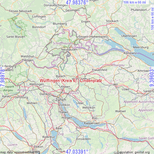
| Map corner | latitude | longitude |
|---|---|---|
| Upper-left | 47.98376°, | 7.98978° |
| Center: | 47.51098°, | 8.6929° |
| Lower-right: | 47.03391°, | 9.39603° |
| Map W x H: | 105.6×105.6 km | = 65.6×65.6mi |
| max Lat: | 47.76737° ⇑9.1% North |
| Wülflingen (Kreis 6) / Lindenplatz: | 47.51098° |
| min Lat: | ⇓90.9% South 45.83203° |
| min Long | Wülflingen (Kr | max Long |
| 5.97153° | 8.6929° | 10.44624° |
| W 73.8%⇐ | ⇒26.2% E |
Elevation
Elevation of Wülflingen (Kreis 6) / Lindenplatz is 419 m = 1375 ft, and this is 139.2 m = 457 ft below average elevation for this country.
| Max E: |
1845 m = 6053 ft | 81.2% |
| Avg. | 558.2 m = 1831 ft | |
| Wülflingen (Kreis 6) / Lindenplatz | 419 m = 1375 ft | |
Min E: |
197 m = 646 ft | 18.8% |
See also: Switzerland elevation on elevation.city.
Geographical zone
Wülflingen (Kreis 6) / Lindenplatz is located in North temperate zone (between Tropic of Cancer and the Arctic Circle). Distance of this North polar circle is 2118.4 km =1316.3 mi to North.| Distance of | km | miles | from Wülflingen (Kreis 6) / Lindenplatz |
|---|---|---|---|
| North Pole | 4724.3 | 2935.5 | to North |
| Arctic Circle | 2118.4 | 1316.3 | to North |
| Tropic Cancer | 2676.8 | 1663.3 | to South |
| Equator | 5282.7 | 3282.5 | to South |


Nearby cities:
15 places around Wülflingen (Kreis 6) / Lindenplatz: (largest is in red/bold)
• Ober-Ohringen
2.3 km =1.4 mi,  42°
42°
• Stadt Winterthur (Kreis 1)
2.7 km =1.7 mi,  131°
131°
• Stadt Winterthur (Kreis 1) / Brühlberg
2.1 km =1.3 mi, 134°
• Stadt Winterthur (Kreis 1) / Neuwiesen
2 km =1.2 mi,  119°
119°
• Stadt Winterthur (Kreis 1) / Tössfeld
2.6 km =1.6 mi,  139°
139°
• Töss (Kreis 4) / Schlosstal
2.1 km =1.3 mi,  160°
160°
• Veltheim (Kreis 5)
1.8 km =1.1 mi,  78°
78°
• Veltheim (Kreis 5) / Blumenau
1.8 km =1.1 mi,  107°
107°
• Veltheim (Kreis 5) / Rosenberg
1.8 km =1.1 mi, 79°
• Winterthur
2.4 km =1.5 mi,  104°
104°
• Wülflingen (Kreis 6)
0.7 km =0.4 mi,  264°
264°
• Wülflingen (Kreis 6) / Härti
0.7 km =0.4 mi,  285°
285°
• Wülflingen (Kreis 6) / Niederfeld
1 km =0.6 mi, 257°
• Wülflingen (Kreis 6) / Oberfeld
1.4 km =0.9 mi, 161°
• Wülflingen (Kreis 6) / Weinberg
0.6 km =0.4 mi,  90°
90°
Sources, notices
• [Note1] Compared only with cities in Switzerland existing in our database
• [Src1] Map data: © OpenStreetMap contributors (CC-BY-SA)
• [Src2] Other city data from geonames.org with taken over terms of usage.
• [Src3] Geographical zone / Annual Mean Temperature by Robert A. Rohde @ Wikipedia
