Mattenbach (Kreis 7) / Deutweg geodata
Mattenbach (Kreis 7) / Deutweg (Zurich) is a section of populated place; located in Switzerland in Europe/Zurich (GMT+2) time zone. With population of 5,930 people, there are 277 cities with bigger population in this country. Compared to other cities in Switzerland, 88.1% of cities are located further ↓South; 77.6% of cities are located further ←West and 64.5% of cities have higher elevation than Mattenbach (Kreis 7) / Deutweg. Note1
Current local time in Mattenbach (Kreis 7) / Deutweg:
07:37 AM, SaturdayDifference from your time zone: hours


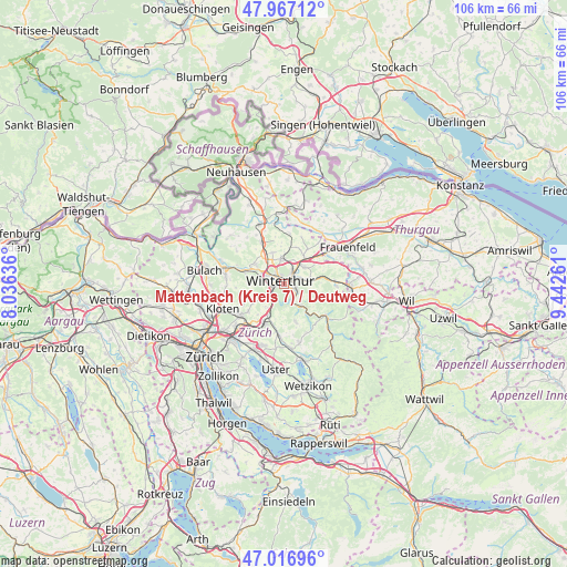
Mattenbach (Kreis 7) / Deutweg GPS coordinates[2]
47° 29' 39.084" North, 8° 44' 22.128" East
| Map corner | latitude | longitude |
|---|---|---|
| Upper-left | 47.96712°, | 8.03636° |
| Center: | 47.49419°, | 8.73948° |
| Lower-right: | 47.01696°, | 9.44261° |
| Map W x H: | 105.6×105.6 km | = 65.6×65.6mi |
| max Lat: | 47.76737° ⇑11.9% North |
| Mattenbach (Kreis 7) / Deutweg: | 47.49419° |
| min Lat: | ⇓88.1% South 45.83203° |
| min Long | Mattenbach (Kre | max Long |
| 5.97153° | 8.73948° | 10.44624° |
| W 77.6%⇐ | ⇒22.4% E |
Elevation
Elevation of Mattenbach (Kreis 7) / Deutweg is 447 m = 1467 ft, and this is 111.2 m = 365 ft below average elevation for this country.
| Max E: |
1845 m = 6053 ft | 64.5% |
| Avg. | 558.2 m = 1831 ft | |
| Mattenbach (Kreis 7) / Deutweg | 447 m = 1467 ft | |
Min E: |
197 m = 646 ft | 35.5% |
See also: Switzerland elevation on elevation.city.
Geographical zone
Mattenbach (Kreis 7) / Deutweg is located in North temperate zone (between Tropic of Cancer and the Arctic Circle). Distance of this North polar circle is 2120.3 km =1317.5 mi to North.| Distance of | km | miles | from Mattenbach (Kreis 7) / Deutweg |
|---|---|---|---|
| North Pole | 4726.2 | 2936.7 | to North |
| Arctic Circle | 2120.3 | 1317.5 | to North |
| Tropic Cancer | 2674.9 | 1662.1 | to South |
| Equator | 5280.9 | 3281.4 | to South |


Nearby cities:
15 places around Mattenbach (Kreis 7) / Deutweg: (largest is in red/bold)
• Mattenbach (Kreis 7)
1 km =0.6 mi,  145°
145°
• Mattenbach (Kreis 7) / Endliker
1 km =0.6 mi,  131°
131°
• Mattenbach (Kreis 7) / Gutschick
1 km =0.6 mi,  109°
109°
• Oberwinterthur (Kreis 2) / Grüze
1.4 km =0.9 mi,  71°
71°
• Oberwinterthur (Kreis 2) / Talacker
1.6 km =1 mi,  34°
34°
• Seen (Kreis 3) / Waldegg
1.7 km =1.1 mi, 132°
• Seen (Kreis 3) / Waser
1.7 km =1.1 mi, 109°
• Stadt Winterthur (Kreis 1)
1.5 km =0.9 mi,  273°
273°
• Stadt Winterthur (Kreis 1) / Altstadt
1 km =0.6 mi,  306°
306°
• Stadt Winterthur (Kreis 1) / Brühlberg
2 km =1.2 mi,  280°
280°
• Stadt Winterthur (Kreis 1) / Heiligberg
1.2 km =0.7 mi, 269°
• Stadt Winterthur (Kreis 1) / Lind
1.4 km =0.9 mi,  341°
341°
• Stadt Winterthur (Kreis 1) / Neuwiesen
2 km =1.2 mi,  296°
296°
• Stadt Winterthur (Kreis 1) / Tössfeld
1.8 km =1.1 mi, 267°
• Winterthur
1.7 km =1.1 mi,  317°
317°
Sources, notices
• [Note1] Compared only with cities in Switzerland existing in our database
• [Src1] Map data: © OpenStreetMap contributors (CC-BY-SA)
• [Src2] Other city data from geonames.org with taken over terms of usage.
• [Src3] Geographical zone / Annual Mean Temperature by Robert A. Rohde @ Wikipedia
