Oberwinterthur (Kreis 2) / Grüze geodata
Oberwinterthur (Kreis 2) / Grüze (Zurich) is a section of populated place; located in Switzerland in Europe/Zurich (GMT+2) time zone. With population of 575 people, there are 1719 cities with bigger population in this country. Compared to other cities in Switzerland, 88.8% of cities are located further ↓South; 78.4% of cities are located further ←West and 61% of cities have higher elevation than Oberwinterthur (Kreis 2) / Grüze. Note1
Current local time in Oberwinterthur (Kreis 2) / Grüze:
07:38 AM, SaturdayDifference from your time zone: hours


Oberwinterthur (Kreis 2) / Grüze GPS coordinates[2]
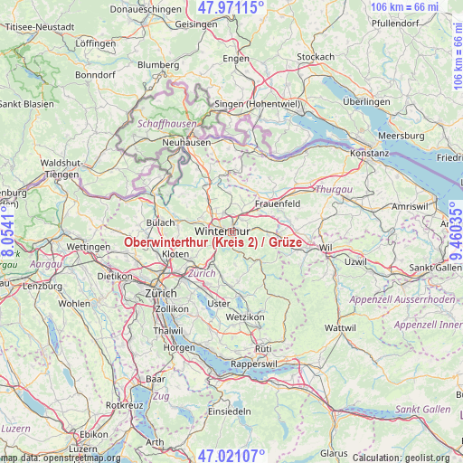
47° 29' 53.736" North, 8° 45' 26.028" East
| Map corner | latitude | longitude |
|---|---|---|
| Upper-left | 47.97115°, | 8.0541° |
| Center: | 47.49826°, | 8.75723° |
| Lower-right: | 47.02107°, | 9.46035° |
| Map W x H: | 105.6×105.6 km | = 65.6×65.6mi |
| max Lat: | 47.76737° ⇑11.2% North |
| Oberwinterthur (Kreis 2) / Grüze: | 47.49826° |
| min Lat: | ⇓88.8% South 45.83203° |
| min Long | Oberwinterthur | max Long |
| 5.97153° | 8.75723° | 10.44624° |
| W 78.4%⇐ | ⇒21.6% E |
Elevation
Elevation of Oberwinterthur (Kreis 2) / Grüze is 453 m = 1486 ft, and this is 105.2 m = 345 ft below average elevation for this country.
| Max E: |
1845 m = 6053 ft | 61% |
| Avg. | 558.2 m = 1831 ft | |
| Oberwinterthur (Kreis 2) / Grüze | 453 m = 1486 ft | |
Min E: |
197 m = 646 ft | 39% |
See also: Switzerland elevation on elevation.city.
Geographical zone
Oberwinterthur (Kreis 2) / Grüze is located in North temperate zone (between Tropic of Cancer and the Arctic Circle). Distance of this North polar circle is 2119.9 km =1317.2 mi to North.| Distance of | km | miles | from Oberwinterthur (Kreis 2) / Grüze |
|---|---|---|---|
| North Pole | 4725.8 | 2936.5 | to North |
| Arctic Circle | 2119.9 | 1317.2 | to North |
| Tropic Cancer | 2675.4 | 1662.4 | to South |
| Equator | 5281.3 | 3281.6 | to South |


Nearby cities:
15 places around Oberwinterthur (Kreis 2) / Grüze: (largest is in red/bold)
• Mattenbach (Kreis 7)
1.5 km =0.9 mi,  212°
212°
• Mattenbach (Kreis 7) / Deutweg
1.4 km =0.9 mi,  251°
251°
• Mattenbach (Kreis 7) / Endliker
1.3 km =0.8 mi, 207°
• Mattenbach (Kreis 7) / Gutschick
0.9 km =0.6 mi,  203°
203°
• Oberwinterthur (Kreis 2) / Guggenbühl
1.7 km =1.1 mi,  6°
6°
• Oberwinterthur (Kreis 2) / Hegi
1.4 km =0.9 mi,  45°
45°
• Oberwinterthur (Kreis 2) / Hegmatten
1.3 km =0.8 mi,  17°
17°
• Oberwinterthur (Kreis 2) / Talacker
1 km =0.6 mi,  333°
333°
• Seen (Kreis 3) / Büelwiesen
1.6 km =1 mi,  158°
158°
• Seen (Kreis 3) / Ganzenbühl
2 km =1.2 mi,  168°
168°
• Seen (Kreis 3) / Sonnenberg
1.4 km =0.9 mi,  134°
134°
• Seen (Kreis 3) / Waldegg
1.6 km =1 mi,  183°
183°
• Seen (Kreis 3) / Waser
1 km =0.6 mi, 167°
• Stadt Winterthur (Kreis 1) / Altstadt
2.1 km =1.3 mi,  273°
273°
• Stadt Winterthur (Kreis 1) / Lind
2 km =1.2 mi,  295°
295°
Sources, notices
• [Note1] Compared only with cities in Switzerland existing in our database
• [Src1] Map data: © OpenStreetMap contributors (CC-BY-SA)
• [Src2] Other city data from geonames.org with taken over terms of usage.
• [Src3] Geographical zone / Annual Mean Temperature by Robert A. Rohde @ Wikipedia
