Oberwinterthur (Kreis 2) / Talacker geodata
Oberwinterthur (Kreis 2) / Talacker (Zurich) is a section of populated place; located in Switzerland in Europe/Zurich (GMT+2) time zone. With population of 5,375 people, there are 315 cities with bigger population in this country. Compared to other cities in Switzerland, 90.1% of cities are located further ↓South; 78.2% of cities are located further ←West and 51.4% of cities have higher elevation than Oberwinterthur (Kreis 2) / Talacker. Note1
Current local time in Oberwinterthur (Kreis 2) / Talacker:
08:55 AM, SaturdayDifference from your time zone: hours


Oberwinterthur (Kreis 2) / Talacker GPS coordinates[2]
47° 30' 21.456" North, 8° 45' 5.4" East
| Map corner | latitude | longitude |
|---|---|---|
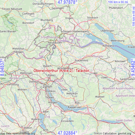
| Upper-left | 47.97878°, | 8.04837° |
| Center: | 47.50596°, | 8.7515° |
| Lower-right: | 47.02884°, | 9.45462° |
| Map W x H: | 105.6×105.6 km | = 65.6×65.6mi |
| max Lat: | 47.76737° ⇑9.9% North |
| Oberwinterthur (Kreis 2) / Talacker: | 47.50596° |
| min Lat: | ⇓90.1% South 45.83203° |
| min Long | Oberwinterthur | max Long |
| 5.97153° | 8.7515° | 10.44624° |
| W 78.2%⇐ | ⇒21.8% E |
Elevation
Elevation of Oberwinterthur (Kreis 2) / Talacker is 475 m = 1558 ft, and this is 83.2 m = 273 ft below average elevation for this country.
| Max E: |
1845 m = 6053 ft | 51.4% |
| Avg. | 558.2 m = 1831 ft | |
| Oberwinterthur (Kreis 2) / Talacker | 475 m = 1558 ft | |
Min E: |
197 m = 646 ft | 48.6% |
See also: Switzerland elevation on elevation.city.
Geographical zone
Oberwinterthur (Kreis 2) / Talacker is located in North temperate zone (between Tropic of Cancer and the Arctic Circle). Distance of this North polar circle is 2119 km =1316.7 mi to North.| Distance of | km | miles | from Oberwinterthur (Kreis 2) / Talacker |
|---|---|---|---|
| North Pole | 4724.9 | 2935.9 | to North |
| Arctic Circle | 2119 | 1316.7 | to North |
| Tropic Cancer | 2676.2 | 1662.9 | to South |
| Equator | 5282.2 | 3282.2 | to South |


Nearby cities:
15 places around Oberwinterthur (Kreis 2) / Talacker: (largest is in red/bold)
• Mattenbach (Kreis 7)
2.1 km =1.3 mi,  189°
189°
• Mattenbach (Kreis 7) / Deutweg
1.6 km =1 mi,  214°
214°
• Mattenbach (Kreis 7) / Endliker
2 km =1.2 mi,  184°
184°
• Mattenbach (Kreis 7) / Gutschick
1.7 km =1.1 mi, 177°
• Oberwinterthur (Kreis 2)
1.8 km =1.1 mi,  46°
46°
• Oberwinterthur (Kreis 2) / Grüze
1 km =0.6 mi,  153°
153°
• Oberwinterthur (Kreis 2) / Guggenbühl
1 km =0.6 mi,  37°
37°
• Oberwinterthur (Kreis 2) / Hegi
1.4 km =0.9 mi,  84°
84°
• Oberwinterthur (Kreis 2) / Hegmatten
0.9 km =0.6 mi,  63°
63°
• Oberwinterthur (Kreis 2) / Zinzikon
1.5 km =0.9 mi,  13°
13°
• Seen (Kreis 3) / Sonnenberg
2.3 km =1.4 mi,  142°
142°
• Seen (Kreis 3) / Waser
2 km =1.2 mi,  160°
160°
• Stadt Winterthur (Kreis 1) / Altstadt
1.9 km =1.2 mi,  247°
247°
• Stadt Winterthur (Kreis 1) / Lind
1.3 km =0.8 mi,  268°
268°
• Winterthur
2.1 km =1.3 mi, 269°
Sources, notices
• [Note1] Compared only with cities in Switzerland existing in our database
• [Src1] Map data: © OpenStreetMap contributors (CC-BY-SA)
• [Src2] Other city data from geonames.org with taken over terms of usage.
• [Src3] Geographical zone / Annual Mean Temperature by Robert A. Rohde @ Wikipedia
