Schlieren / Engstingerquartier geodata
Schlieren / Engstingerquartier (Zurich) is a section of populated place; located in Switzerland in Europe/Zurich (GMT+2) time zone. With population of 1,877 people, there are 881 cities with bigger population in this country. Compared to other cities in Switzerland, 74.4% of cities are located further ↓South; 52.7% of cities are located further ←West and 90.5% of cities have higher elevation than Schlieren / Engstingerquartier. Note1
Current local time in Schlieren / Engstingerquartier:
07:44 AM, SaturdayDifference from your time zone: hours


Schlieren / Engstingerquartier GPS coordinates[2]
47° 24' 12.168" North, 8° 26' 36.672" East
| Map corner | latitude | longitude |
|---|---|---|
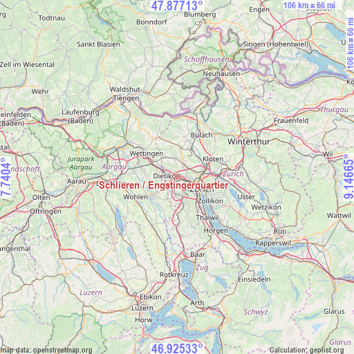
| Upper-left | 47.87713°, | 7.7404° |
| Center: | 47.40338°, | 8.44352° |
| Lower-right: | 46.92533°, | 9.14665° |
| Map W x H: | 105.8×105.8 km | = 65.7×65.7mi |
| max Lat: | 47.76737° ⇑25.6% North |
| Schlieren / Engstingerquartier: | 47.40338° |
| min Lat: | ⇓74.4% South 45.83203° |
| min Long | Schlieren / Eng | max Long |
| 5.97153° | 8.44352° | 10.44624° |
| W 52.7%⇐ | ⇒47.3% E |
Elevation
Elevation of Schlieren / Engstingerquartier is 392 m = 1286 ft, and this is 166.2 m = 545 ft below average elevation for this country.
| Max E: |
1845 m = 6053 ft | 90.5% |
| Avg. | 558.2 m = 1831 ft | |
| Schlieren / Engstingerquartier | 392 m = 1286 ft | |
Min E: |
197 m = 646 ft | 9.5% |
See also: Switzerland elevation on elevation.city.
Geographical zone
Schlieren / Engstingerquartier is located in North temperate zone (between Tropic of Cancer and the Arctic Circle). Distance of this North polar circle is 2130.4 km =1323.8 mi to North.| Distance of | km | miles | from Schlieren / Engstingerquartier |
|---|---|---|---|
| North Pole | 4736.3 | 2943 | to North |
| Arctic Circle | 2130.4 | 1323.8 | to North |
| Tropic Cancer | 2664.8 | 1655.8 | to South |
| Equator | 5270.8 | 3275.1 | to South |


Nearby cities:
15 places around Schlieren / Engstingerquartier: (largest is in red/bold)
• Dietikon / Schönenwerd
1.5 km =0.9 mi,  242°
242°
• Oberengstringen
1.7 km =1.1 mi,  71°
71°
• Oberengstringen / Rauchacher
1.2 km =0.7 mi,  56°
56°
• Oberengstringen / Sonnenberg
1.6 km =1 mi,  52°
52°
• Oberengstringen / Zentrum
1.5 km =0.9 mi, 74°
• Schlieren
0.8 km =0.5 mi,  157°
157°
• Schlieren / Boden
1.2 km =0.7 mi,  123°
123°
• Schlieren / Freiestrasse
0.8 km =0.5 mi,  187°
187°
• Schlieren / Halde
1.6 km =1 mi, 121°
• Schlieren / Industrie Ost
1.3 km =0.8 mi,  102°
102°
• Schlieren / Kamp
1.1 km =0.7 mi,  176°
176°
• Schlieren / Pflugstrasse
1 km =0.6 mi,  215°
215°
• Schlieren / Spital
1.4 km =0.9 mi,  226°
226°
• Schlieren / Zentrum
0.7 km =0.4 mi,  153°
153°
• Unterengstringen
1.2 km =0.7 mi,  14°
14°
Sources, notices
• [Note1] Compared only with cities in Switzerland existing in our database
• [Src1] Map data: © OpenStreetMap contributors (CC-BY-SA)
• [Src2] Other city data from geonames.org with taken over terms of usage.
• [Src3] Geographical zone / Annual Mean Temperature by Robert A. Rohde @ Wikipedia
