Schlieren / Pflugstrasse geodata
Schlieren / Pflugstrasse (Zurich) is a section of populated place; located in Switzerland in Europe/Zurich (GMT+2) time zone. With population of 704 people, there are 1592 cities with bigger population in this country. Compared to other cities in Switzerland, 72.9% of cities are located further ↓South; 52.1% of cities are located further ←West and 90.1% of cities have higher elevation than Schlieren / Pflugstrasse. Note1
Current local time in Schlieren / Pflugstrasse:
10:17 AM, SaturdayDifference from your time zone: hours


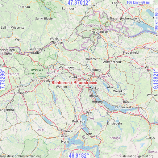
Schlieren / Pflugstrasse GPS coordinates[2]
47° 23' 46.716" North, 8° 26' 9.888" East
| Map corner | latitude | longitude |
|---|---|---|
| Upper-left | 47.87012°, | 7.73296° |
| Center: | 47.39631°, | 8.43608° |
| Lower-right: | 46.9182°, | 9.13921° |
| Map W x H: | 105.8×105.8 km | = 65.7×65.7mi |
| max Lat: | 47.76737° ⇑27.1% North |
| Schlieren / Pflugstrasse: | 47.39631° |
| min Lat: | ⇓72.9% South 45.83203° |
| min Long | Schlieren / Pfl | max Long |
| 5.97153° | 8.43608° | 10.44624° |
| W 52.1%⇐ | ⇒47.9% E |
Elevation
Elevation of Schlieren / Pflugstrasse is 394 m = 1293 ft, and this is 164.2 m = 539 ft below average elevation for this country.
| Max E: |
1845 m = 6053 ft | 90.1% |
| Avg. | 558.2 m = 1831 ft | |
| Schlieren / Pflugstrasse | 394 m = 1293 ft | |
Min E: |
197 m = 646 ft | 9.9% |
See also: Switzerland elevation on elevation.city.
Geographical zone
Schlieren / Pflugstrasse is located in North temperate zone (between Tropic of Cancer and the Arctic Circle). Distance of this North polar circle is 2131.2 km =1324.3 mi to North.| Distance of | km | miles | from Schlieren / Pflugstrasse |
|---|---|---|---|
| North Pole | 4737.1 | 2943.5 | to North |
| Arctic Circle | 2131.2 | 1324.3 | to North |
| Tropic Cancer | 2664.1 | 1655.4 | to South |
| Equator | 5270 | 3274.6 | to South |


Nearby cities:
15 places around Schlieren / Pflugstrasse: (largest is in red/bold)
• Dietikon / Hofacker
1.5 km =0.9 mi,  273°
273°
• Dietikon / Schönenwerd
0.8 km =0.5 mi,  276°
276°
• Schlieren
0.9 km =0.6 mi,  87°
87°
• Schlieren / Engstingerquartier
1 km =0.6 mi,  35°
35°
• Schlieren / Freiestrasse
0.4 km =0.2 mi, 94°
• Schlieren / Kamp
0.7 km =0.4 mi,  115°
115°
• Schlieren / Spital
0.5 km =0.3 mi,  250°
250°
• Schlieren / Zentrum
0.9 km =0.6 mi,  79°
79°
• Urdorf
1.5 km =0.9 mi,  211°
211°
• Urdorf / Bodenfeld
1.3 km =0.8 mi,  231°
231°
• Urdorf / Heidenkeller
1.4 km =0.9 mi, 206°
• Urdorf / Moos
0.9 km =0.6 mi,  216°
216°
• Urdorf / Nieder-Urdorf
1.3 km =0.8 mi, 253°
• Urdorf / Ob der Bahn
1.1 km =0.7 mi,  192°
192°
• Urdorf / Zentrum
1.5 km =0.9 mi, 218°
Sources, notices
• [Note1] Compared only with cities in Switzerland existing in our database
• [Src1] Map data: © OpenStreetMap contributors (CC-BY-SA)
• [Src2] Other city data from geonames.org with taken over terms of usage.
• [Src3] Geographical zone / Annual Mean Temperature by Robert A. Rohde @ Wikipedia
