Zürich (Kreis 10) / Rütihof geodata
Zürich (Kreis 10) / Rütihof (Zurich) is a section of populated place; located in Switzerland in Europe/Zurich (GMT+2) time zone. With population of 3,326 people, there are 524 cities with bigger population in this country. Compared to other cities in Switzerland, 76.7% of cities are located further ↓South; 55.8% of cities are located further ←West and 55.9% of cities have lower elevation than Zürich (Kreis 10) / Rütihof. Note1
Current local time in Zürich (Kreis 10) / Rütihof:
08:58 AM, SaturdayDifference from your time zone: hours


Zürich (Kreis 10) / Rütihof GPS coordinates[2]
47° 24' 51.984" North, 8° 28' 45.408" East
| Map corner | latitude | longitude |
|---|---|---|
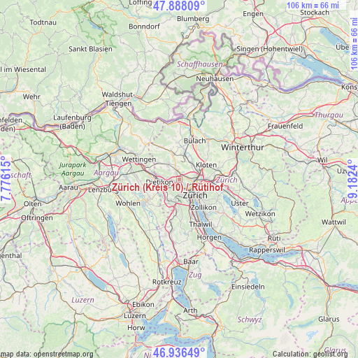
| Upper-left | 47.88809°, | 7.77615° |
| Center: | 47.41444°, | 8.47928° |
| Lower-right: | 46.93649°, | 9.1824° |
| Map W x H: | 105.8×105.8 km | = 65.7×65.7mi |
| max Lat: | 47.76737° ⇑23.3% North |
| Zürich (Kreis 10) / Rütihof: | 47.41444° |
| min Lat: | ⇓76.7% South 45.83203° |
| min Long | Zürich (Kreis | max Long |
| 5.97153° | 8.47928° | 10.44624° |
| W 55.8%⇐ | ⇒44.2% E |
Elevation
Elevation of Zürich (Kreis 10) / Rütihof is 500 m = 1640 ft, and this is 58.2 m = 191 ft below average elevation for this country.
| Max E: |
1845 m = 6053 ft | 44.1% |
| Avg. | 558.2 m = 1831 ft | |
| Zürich (Kreis 10) / Rütihof | 500 m = 1640 ft | |
Min E: |
197 m = 646 ft | 55.9% |
See also: Switzerland elevation on elevation.city.
Geographical zone
Zürich (Kreis 10) / Rütihof is located in North temperate zone (between Tropic of Cancer and the Arctic Circle). Distance of this North polar circle is 2129.2 km =1323 mi to North.| Distance of | km | miles | from Zürich (Kreis 10) / Rütihof |
|---|---|---|---|
| North Pole | 4735.1 | 2942.3 | to North |
| Arctic Circle | 2129.2 | 1323 | to North |
| Tropic Cancer | 2666.1 | 1656.6 | to South |
| Equator | 5272 | 3275.9 | to South |


Nearby cities:
15 places around Zürich (Kreis 10) / Rütihof: (largest is in red/bold)
• Oberengstringen
1.3 km =0.8 mi,  237°
237°
• Oberengstringen / Eggbühl
1 km =0.6 mi,  211°
211°
• Oberengstringen / Kirchweg
1.1 km =0.7 mi, 205°
• Oberengstringen / Rauchacher
1.8 km =1.1 mi,  251°
251°
• Oberengstringen / Sonnenberg
1.4 km =0.9 mi,  259°
259°
• Oberengstringen / Zentrum
1.5 km =0.9 mi, 236°
• Regensdorf
2.3 km =1.4 mi,  340°
340°
• Regensdorf / Hubacher
2.2 km =1.4 mi,  320°
320°
• Regensdorf / Obstgarten
1.8 km =1.1 mi,  325°
325°
• Regensdorf / Watterstrasse
2.2 km =1.4 mi, 342°
• Regensdorf / Zentrum
2 km =1.2 mi, 336°
• Schlieren / Industrie Ost
2.1 km =1.3 mi,  222°
222°
• Unterengstringen
2.4 km =1.5 mi,  268°
268°
• Zürich (Kreis 10)
1.8 km =1.1 mi,  115°
115°
• Zürich (Kreis 10) / Höngg
1.8 km =1.1 mi,  133°
133°
Sources, notices
• [Note1] Compared only with cities in Switzerland existing in our database
• [Src1] Map data: © OpenStreetMap contributors (CC-BY-SA)
• [Src2] Other city data from geonames.org with taken over terms of usage.
• [Src3] Geographical zone / Annual Mean Temperature by Robert A. Rohde @ Wikipedia
