Regensdorf / Zentrum geodata
Regensdorf / Zentrum (Zurich) is a section of populated place; located in Switzerland in Europe/Zurich (GMT+2) time zone. With population of 650 people, there are 1649 cities with bigger population in this country. Compared to other cities in Switzerland, 79.5% of cities are located further ↓South; 55.1% of cities are located further ←West and 65.9% of cities have higher elevation than Regensdorf / Zentrum. Note1


Regensdorf / Zentrum GPS coordinates[2]
47° 25' 50.736" North, 8° 28' 8.328" East
| Map corner | latitude | longitude |
|---|---|---|
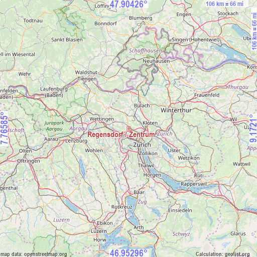
| Upper-left | 47.90426°, | 7.76585° |
| Center: | 47.43076°, | 8.46898° |
| Lower-right: | 46.95296°, | 9.1721° |
| Map W x H: | 105.8×105.8 km | = 65.7×65.7mi |
| max Lat: | 47.76737° ⇑20.5% North |
| Regensdorf / Zentrum: | 47.43076° |
| min Lat: | ⇓79.5% South 45.83203° |
| min Long | Regensdorf / Ze | max Long |
| 5.97153° | 8.46898° | 10.44624° |
| W 55.1%⇐ | ⇒44.9% E |
Elevation
Elevation of Regensdorf / Zentrum is 445 m = 1460 ft, and this is 113.2 m = 371 ft below average elevation for this country.
| Max E: |
1845 m = 6053 ft | 65.9% |
| Avg. | 558.2 m = 1831 ft | |
| Regensdorf / Zentrum | 445 m = 1460 ft | |
Min E: |
197 m = 646 ft | 34.1% |
See also: Switzerland elevation on elevation.city.
Geographical zone
Regensdorf / Zentrum is located in North temperate zone (between Tropic of Cancer and the Arctic Circle). Distance of this North polar circle is 2127.4 km =1321.9 mi to North.| Distance of | km | miles | from Regensdorf / Zentrum |
|---|---|---|---|
| North Pole | 4733.3 | 2941.1 | to North |
| Arctic Circle | 2127.4 | 1321.9 | to North |
| Tropic Cancer | 2667.9 | 1657.8 | to South |
| Equator | 5273.8 | 3277 | to South |


Nearby cities:
15 places around Regensdorf / Zentrum: (largest is in red/bold)
• Adlikon
1.8 km =1.1 mi,  353°
353°
• Dällikon / Dällikon (Dorf)
2.5 km =1.6 mi,  293°
293°
• Dällikon / Sytenacher
2 km =1.2 mi,  295°
295°
• Laubisser
2 km =1.2 mi,  16°
16°
• Oberengstringen
2.5 km =1.6 mi,  186°
186°
• Oberengstringen / Sonnenberg
2.2 km =1.4 mi,  197°
197°
• Regensdorf
0.4 km =0.2 mi,  357°
357°
• Regensdorf / Feldblumen-Riedthofstrasse
0.6 km =0.4 mi,  343°
343°
• Regensdorf / Hofacher-Geeren
0.7 km =0.4 mi,  315°
315°
• Regensdorf / Hubacher
0.6 km =0.4 mi,  256°
256°
• Regensdorf / Obstgarten
0.4 km =0.2 mi,  216°
216°
• Regensdorf / Watterstrasse
0.3 km =0.2 mi, 19°
• Sand
1.3 km =0.8 mi,  32°
32°
• Unterengstringen
2.5 km =1.6 mi, 220°
• Zürich (Kreis 10) / Rütihof
2 km =1.2 mi,  156°
156°
Sources, notices
• [Note1] Compared only with cities in Switzerland existing in our database
• [Src1] Map data: © OpenStreetMap contributors (CC-BY-SA)
• [Src2] Other city data from geonames.org with taken over terms of usage.
• [Src3] Geographical zone / Annual Mean Temperature by Robert A. Rohde @ Wikipedia
