Zürich (Kreis 1) / Hochschulen geodata
Zürich (Kreis 1) / Hochschulen (Zurich) is a section of populated place; located in Switzerland in Europe/Zurich (GMT+2) time zone. With population of 707 people, there are 1584 cities with bigger population in this country. Compared to other cities in Switzerland, 67.1% of cities are located further ↓South; 61.4% of cities are located further ←West and 85.1% of cities have higher elevation than Zürich (Kreis 1) / Hochschulen. Note1
Current local time in Zürich (Kreis 1) / Hochschulen:
08:52 AM, SaturdayDifference from your time zone: hours


Zürich (Kreis 1) / Hochschulen GPS coordinates[2]
47° 21' 57.636" North, 8° 32' 45.384" East
| Map corner | latitude | longitude |
|---|---|---|
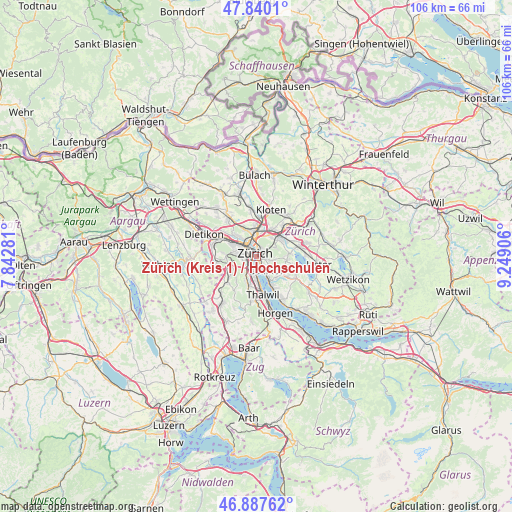
| Upper-left | 47.8401°, | 7.84281° |
| Center: | 47.36601°, | 8.54594° |
| Lower-right: | 46.88762°, | 9.24906° |
| Map W x H: | 105.9×105.9 km | = 65.8×65.8mi |
| max Lat: | 47.76737° ⇑32.9% North |
| Zürich (Kreis 1) / Hochschulen: | 47.36601° |
| min Lat: | ⇓67.1% South 45.83203° |
| min Long | Zürich (Kreis | max Long |
| 5.97153° | 8.54594° | 10.44624° |
| W 61.4%⇐ | ⇒38.6% E |
Elevation
Elevation of Zürich (Kreis 1) / Hochschulen is 410 m = 1345 ft, and this is 148.2 m = 486 ft below average elevation for this country.
| Max E: |
1845 m = 6053 ft | 85.1% |
| Avg. | 558.2 m = 1831 ft | |
| Zürich (Kreis 1) / Hochschulen | 410 m = 1345 ft | |
Min E: |
197 m = 646 ft | 14.9% |
See also: Switzerland elevation on elevation.city.
Geographical zone
Zürich (Kreis 1) / Hochschulen is located in North temperate zone (between Tropic of Cancer and the Arctic Circle). Distance of this North polar circle is 2134.6 km =1326.4 mi to North.| Distance of | km | miles | from Zürich (Kreis 1) / Hochschulen |
|---|---|---|---|
| North Pole | 4740.5 | 2945.6 | to North |
| Arctic Circle | 2134.6 | 1326.4 | to North |
| Tropic Cancer | 2660.7 | 1653.3 | to South |
| Equator | 5266.6 | 3272.5 | to South |


Nearby cities:
15 places around Zürich (Kreis 1) / Hochschulen: (largest is in red/bold)
• Zürich
0.3 km =0.2 mi,  76°
76°
• Zürich (Kreis 1)
0.6 km =0.4 mi,  328°
328°
• Zürich (Kreis 1) / City
1.1 km =0.7 mi,  314°
314°
• Zürich (Kreis 1) / Lindenhof
0.8 km =0.5 mi, 327°
• Zürich (Kreis 1) / Rathaus
0.6 km =0.4 mi,  353°
353°
• Zürich (Kreis 2) / Enge
1.3 km =0.8 mi,  240°
240°
• Zürich (Kreis 4) / Aussersihl
2.3 km =1.4 mi,  304°
304°
• Zürich (Kreis 4) / Langstrasse
1.8 km =1.1 mi, 314°
• Zürich (Kreis 4) / Werd
1.6 km =1 mi,  292°
292°
• Zürich (Kreis 7) / Fluntern
2 km =1.2 mi,  36°
36°
• Zürich (Kreis 7) / Hirslanden
1.7 km =1.1 mi,  103°
103°
• Zürich (Kreis 7) / Hottingen
1.4 km =0.9 mi,  70°
70°
• Zürich (Kreis 8)
1.7 km =1.1 mi,  137°
137°
• Zürich (Kreis 8) / Mühlebach
1.3 km =0.8 mi, 138°
• Zürich (Kreis 8) / Seefeld
1.5 km =0.9 mi,  150°
150°
Sources, notices
• [Note1] Compared only with cities in Switzerland existing in our database
• [Src1] Map data: © OpenStreetMap contributors (CC-BY-SA)
• [Src2] Other city data from geonames.org with taken over terms of usage.
• [Src3] Geographical zone / Annual Mean Temperature by Robert A. Rohde @ Wikipedia
