Löhningen geodata
Löhningen (Schaffhausen) is a populated place; located in Switzerland in Europe/Zurich (GMT+2) time zone. With population of 1,124 people, there are 1248 cities with bigger population in this country. Compared to other cities in Switzerland, 99.5% of cities are located further ↓South; 62% of cities are located further ←West and 50.2% of cities have lower elevation than Löhningen. Note1


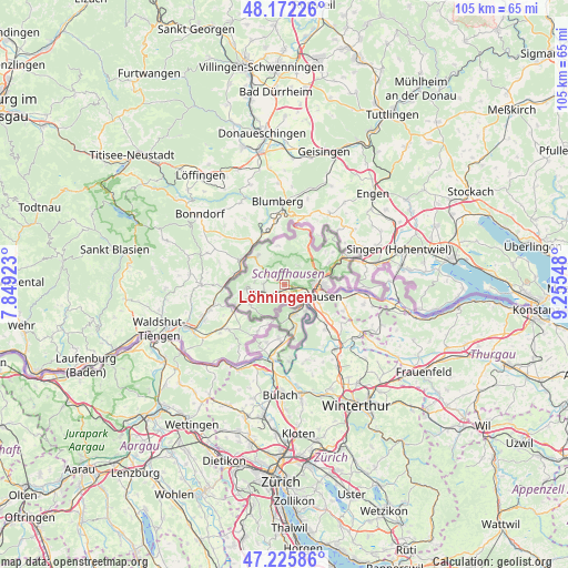
Löhningen GPS coordinates[2]
47° 42' 4.356" North, 8° 33' 8.496" East
| Map corner | latitude | longitude |
|---|---|---|
| Upper-left | 48.17226°, | 7.84923° |
| Center: | 47.70121°, | 8.55236° |
| Lower-right: | 47.22586°, | 9.25548° |
| Map W x H: | 105.2×105.2 km | = 65.4×65.4mi |
| max Lat: | 47.76737° ⇑0.5% North |
| Löhningen: | 47.70121° |
| min Lat: | ⇓99.5% South 45.83203° |
| min Long | Löhningen | max Long |
| 5.97153° | 8.55236° | 10.44624° |
| W 62%⇐ | ⇒38% E |
Elevation
Elevation of Löhningen is 478 m = 1568 ft, and this is 80.2 m = 263 ft below average elevation for this country.
| Max E: |
1845 m = 6053 ft | 49.8% |
| Avg. | 558.2 m = 1831 ft | |
| Löhningen | 478 m = 1568 ft | |
Min E: |
197 m = 646 ft | 50.2% |
See also: Switzerland elevation on elevation.city.
Geographical zone
Löhningen is located in North temperate zone (between Tropic of Cancer and the Arctic Circle). Distance of this North polar circle is 2097.3 km =1303.2 mi to North.| Distance of | km | miles | from Löhningen |
|---|---|---|---|
| North Pole | 4703.2 | 2922.4 | to North |
| Arctic Circle | 2097.3 | 1303.2 | to North |
| Tropic Cancer | 2698 | 1676.5 | to South |
| Equator | 5303.9 | 3295.7 | to South |


Nearby cities:
15 places around Löhningen: (largest is in red/bold)
• Beggingen
7.5 km =4.7 mi,  350°
350°
• Beringen
1.7 km =1.1 mi,  103°
103°
• Dachsen
6.3 km =3.9 mi,  129°
129°
• Feuerthalen
6.9 km =4.3 mi, 99°
• Flurlingen
6.1 km =3.8 mi,  108°
108°
• Gächlingen
4 km =2.5 mi,  273°
273°
• Hallau
7.1 km =4.4 mi, 265°
• Hemmental
4.4 km =2.7 mi,  34°
34°
• Merishausen
7.9 km =4.9 mi, 33°
• Neuhausen
5 km =3.1 mi, 110°
• Neunkirch
4.1 km =2.5 mi,  252°
252°
• Schaffhausen
6.2 km =3.9 mi,  94°
94°
• Schleitheim
7.4 km =4.6 mi,  314°
314°
• Uhwiesen
7.1 km =4.4 mi,  118°
118°
• Wilchingen
7.4 km =4.6 mi,  239°
239°
Sources, notices
• [Note1] Compared only with cities in Switzerland existing in our database
• [Src1] Map data: © OpenStreetMap contributors (CC-BY-SA)
• [Src2] Other city data from geonames.org with taken over terms of usage.
• [Src3] Geographical zone / Annual Mean Temperature by Robert A. Rohde @ Wikipedia
