Hemmental geodata
Hemmental (Schaffhausen) is a populated place; located in Switzerland in Europe/Zurich (GMT+2) time zone. With population of 555 people, there are 1743 cities with bigger population in this country. Compared to other cities in Switzerland, 99.7% of cities are located further ↓South; 64.6% of cities are located further ←West and 74.3% of cities have lower elevation than Hemmental. Note1
Administrative division(s):
- Level 1: Schaffhausen
- Level 2: Bezirk Schaffhausen
- Level 3: Schaffhausen


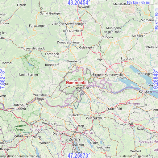
Hemmental GPS coordinates[2]
47° 44' 1.608" North, 8° 35' 7.08" East
| Map corner | latitude | longitude |
|---|---|---|
| Upper-left | 48.20454°, | 7.88218° |
| Center: | 47.73378°, | 8.5853° |
| Lower-right: | 47.25873°, | 9.28843° |
| Map W x H: | 105.2×105.2 km | = 65.4×65.4mi |
| max Lat: | 47.76737° ⇑0.3% North |
| Hemmental: | 47.73378° |
| min Lat: | ⇓99.7% South 45.83203° |
| min Long | Hemmental | max Long |
| 5.97153° | 8.5853° | 10.44624° |
| W 64.6%⇐ | ⇒35.4% E |
Elevation
Elevation of Hemmental is 609 m = 1998 ft, and this is 50.8 m = 167 ft above average elevation for this country.
| Max E: |
1845 m = 6053 ft | 25.7% |
| Hemmental | 609 m 1998 ft | |
| Avg. | 558.2 m = 1831 ft | |
Min E: |
197 m = 646 ft | 74.3% |
See also: Switzerland elevation on elevation.city.
Geographical zone
Hemmental is located in North temperate zone (between Tropic of Cancer and the Arctic Circle). Distance of this North polar circle is 2093.7 km =1301 mi to North.| Distance of | km | miles | from Hemmental |
|---|---|---|---|
| North Pole | 4699.6 | 2920.2 | to North |
| Arctic Circle | 2093.7 | 1301 | to North |
| Tropic Cancer | 2701.6 | 1678.7 | to South |
| Equator | 5307.5 | 3297.9 | to South |


Nearby cities:
15 places around Hemmental: (largest is in red/bold)
• Beggingen
5.3 km =3.3 mi,  315°
315°
• Beringen
4.1 km =2.5 mi,  191°
191°
• Dachsen
8 km =5 mi,  162°
162°
• Feuerthalen
6.5 km =4 mi,  137°
137°
• Flurlingen
6.5 km =4 mi,  148°
148°
• Gächlingen
7.3 km =4.5 mi,  242°
242°
• Langwiesen
7.9 km =4.9 mi,  134°
134°
• Lohn
6.7 km =4.2 mi,  69°
69°
• Löhningen
4.4 km =2.7 mi,  214°
214°
• Merishausen
3.5 km =2.2 mi,  32°
32°
• Neuhausen
5.8 km =3.6 mi, 157°
• Schaffhausen
5.5 km =3.4 mi, 137°
• Schleitheim
7.9 km =4.9 mi,  281°
281°
• Stetten
5.9 km =3.7 mi,  82°
82°
• Uhwiesen
7.9 km =4.9 mi, 151°
Sources, notices
• [Note1] Compared only with cities in Switzerland existing in our database
• [Src1] Map data: © OpenStreetMap contributors (CC-BY-SA)
• [Src2] Other city data from geonames.org with taken over terms of usage.
• [Src3] Geographical zone / Annual Mean Temperature by Robert A. Rohde @ Wikipedia
