Zhanping geodata
Zhanping (Jiangxi) is a seat of a fourth-order administrative division; located in China in Asia/Shanghai (GMT+8) time zone. In our database, there are 1268 cities with bigger population. Compared to other cities in China, 73.9% of cities are located further ↑North; 61.4% of cities are located further ←West and 66.4% of cities have higher elevation than Zhanping. Note1


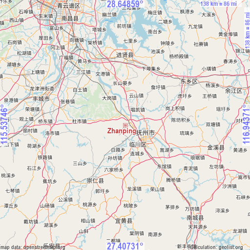
Zhanping GPS coordinates[2]
28° 1' 47.064" North, 116° 14' 26.088" East
| Map corner | latitude | longitude |
|---|---|---|
| Upper-left | 28.64859°, | 115.53746° |
| Center: | 28.02974°, | 116.24058° |
| Lower-right: | 27.40731°, | 116.94371° |
| Map W x H: | 138×138 km | = 85.7×85.7mi |
| max Lat: | 53.31946° ⇑73.9% North |
| Zhanping: | 28.02974° |
| min Lat: | ⇓26.1% South 18.22056° |
| min Long | Zhanping | max Long |
| 75.07348° | 116.24058° | 134.28917° |
| W 61.4%⇐ | ⇒38.6% E |
Elevation
Elevation of Zhanping is 67 m = 220 ft, and this is 417.8 m = 1371 ft below average elevation for this country.
| Max E: |
5622 m = 18445 ft | 66.4% |
| Avg. | 484.8 m = 1591 ft | |
| Zhanping | 67 m = 220 ft | |
Min E: |
-3 m = -10 ft | 33.6% |
See also: China elevation on elevation.city.
Geographical zone
Zhanping is located in North temperate zone (between Tropic of Cancer and the Arctic Circle). Distance of this Northern Tropic circle is 510.7 km =317.3 mi to South.| Distance of | km | miles | from Zhanping |
|---|---|---|---|
| North Pole | 6890.4 | 4281.5 | to North |
| Arctic Circle | 4284.6 | 2662.3 | to North |
| Tropic Cancer | 510.7 | 317.3 | to South |
| Equator | 3116.6 | 1936.6 | to South |


Nearby cities:
15 places around Zhanping: (largest is in red/bold)
• Bailu
13.9 km =8.6 mi,  196°
196°
• Dagang
15.4 km =9.6 mi,  334°
334°
• Fubei
5.7 km =3.5 mi,  116°
116°
• Gaoping
14.2 km =8.8 mi,  216°
216°
• Jinggonglu
11.8 km =7.3 mi,  108°
108°
• Liancheng
16.6 km =10.3 mi,  156°
156°
• Luozhen
10.3 km =6.4 mi,  12°
12°
• Qiaodong
12.4 km =7.7 mi, 105°
• Qingyun
12.4 km =7.7 mi, 113°
• Shangdundu
11.4 km =7.1 mi,  153°
153°
• Taosha
17.2 km =10.7 mi,  277°
277°
• Tongyuan
5.7 km =3.5 mi,  341°
341°
• Wenquan
7.4 km =4.6 mi,  169°
169°
• Xidajie
11.6 km =7.2 mi, 108°
• Zhongling
16.2 km =10.1 mi, 120°
Sources, notices
• [Note1] Compared only with cities in China existing in our database
• [Src1] Map data: © OpenStreetMap contributors (CC-BY-SA)
• [Src2] Other city data from geonames.org with taken over terms of usage.
• [Src3] Geographical zone / Annual Mean Temperature by Robert A. Rohde @ Wikipedia
