Shangdundu geodata
Shangdundu (Jiangxi) is a seat of a fourth-order administrative division; located in China in Asia/Shanghai (GMT+8) time zone. In our database, there are 1268 cities with bigger population. Compared to other cities in China, 74.4% of cities are located further ↑North; 61.7% of cities are located further ←West and 72.3% of cities have higher elevation than Shangdundu. Note1


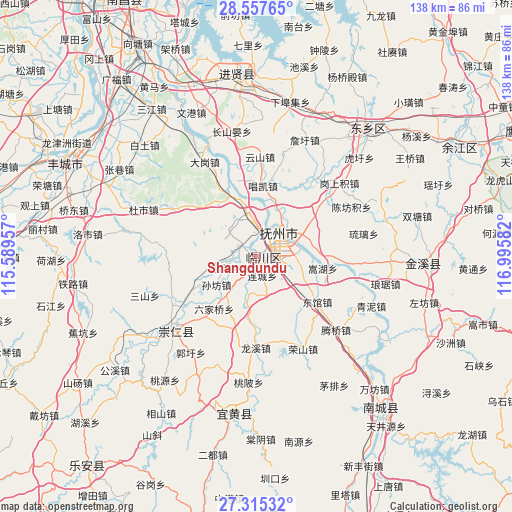
Shangdundu GPS coordinates[2]
27° 56' 17.772" North, 116° 17' 33.684" East
| Map corner | latitude | longitude |
|---|---|---|
| Upper-left | 28.55765°, | 115.58957° |
| Center: | 27.93827°, | 116.29269° |
| Lower-right: | 27.31532°, | 116.99582° |
| Map W x H: | 138.1×138.1 km | = 85.8×85.8mi |
| max Lat: | 53.31946° ⇑74.4% North |
| Shangdundu: | 27.93827° |
| min Lat: | ⇓25.6% South 18.22056° |
| min Long | Shangdundu | max Long |
| 75.07348° | 116.29269° | 134.28917° |
| W 61.7%⇐ | ⇒38.3% E |
Elevation
Elevation of Shangdundu is 44 m = 144 ft, and this is 440.8 m = 1446 ft below average elevation for this country.
| Max E: |
5622 m = 18445 ft | 72.3% |
| Avg. | 484.8 m = 1591 ft | |
| Shangdundu | 44 m = 144 ft | |
Min E: |
-3 m = -10 ft | 27.7% |
See also: China elevation on elevation.city.
Geographical zone
Shangdundu is located in North temperate zone (between Tropic of Cancer and the Arctic Circle). Distance of this Northern Tropic circle is 500.5 km =311 mi to South.| Distance of | km | miles | from Shangdundu |
|---|---|---|---|
| North Pole | 6900.6 | 4287.8 | to North |
| Arctic Circle | 4294.7 | 2668.6 | to North |
| Tropic Cancer | 500.5 | 311 | to South |
| Equator | 3106.4 | 1930.2 | to South |


Nearby cities:
15 places around Shangdundu: (largest is in red/bold)
• Bailu
9.7 km =6 mi,  251°
251°
• Chonggang
8.6 km =5.3 mi,  110°
110°
• Fubei
7.6 km =4.7 mi,  0°
0°
• Gaoping
13.6 km =8.5 mi,  264°
264°
• Hangbu
14.4 km =8.9 mi,  198°
198°
• Jinggonglu
8.9 km =5.5 mi,  43°
43°
• Liancheng
5.3 km =3.3 mi,  164°
164°
• Qiaodong
9.6 km =6 mi, 44°
• Qingyun
8.2 km =5.1 mi,  50°
50°
• Qiuxi
10.2 km =6.3 mi,  191°
191°
• Sunfang
13.3 km =8.3 mi,  234°
234°
• Wenquan
4.8 km =3 mi,  306°
306°
• Xidajie
8.8 km =5.5 mi, 42°
• Zhanping
11.4 km =7.1 mi,  333°
333°
• Zhongling
9.1 km =5.7 mi,  77°
77°
Sources, notices
• [Note1] Compared only with cities in China existing in our database
• [Src1] Map data: © OpenStreetMap contributors (CC-BY-SA)
• [Src2] Other city data from geonames.org with taken over terms of usage.
• [Src3] Geographical zone / Annual Mean Temperature by Robert A. Rohde @ Wikipedia
