Xuwei geodata
Xuwei (Jiangsu) is a seat of a fourth-order administrative division; located in China in Asia/Shanghai (GMT+8) time zone. In our database, there are 1268 cities with bigger population. Compared to other cities in China, 72.9% of cities are located further ↓South; 79.1% of cities are located further ←West and 99.9% of cities have higher elevation than Xuwei. Note1


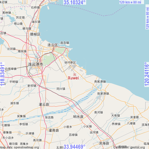
Xuwei GPS coordinates[2]
34° 31' 33.528" North, 119° 32' 16.908" East
| Map corner | latitude | longitude |
|---|---|---|
| Upper-left | 35.10324°, | 118.83491° |
| Center: | 34.52598°, | 119.53803° |
| Lower-right: | 33.94469°, | 120.24116° |
| Map W x H: | 128.8×128.8 km | = 80×80mi |
| max Lat: | 53.31946° ⇑27.1% North |
| Xuwei: | 34.52598° |
| min Lat: | ⇓72.9% South 18.22056° |
| min Long | Xuwei | max Long |
| 75.07348° | 119.53803° | 134.28917° |
| W 79.1%⇐ | ⇒20.9% E |
Elevation
Elevation of Xuwei is -1 m = -3 ft, and this is 485.8 m = 1594 ft below average elevation for this country.
| Max E: |
5622 m = 18445 ft | 99.9% |
| Avg. | 484.8 m = 1591 ft | |
| Xuwei | -1 m = -3 ft | |
Min E: |
-3 m = -10 ft | 0.1% |
See also: China elevation on elevation.city.
Geographical zone
Xuwei is located in North temperate zone (between Tropic of Cancer and the Arctic Circle). Distance of this Northern Tropic circle is 1233 km =766.2 mi to South.| Distance of | km | miles | from Xuwei |
|---|---|---|---|
| North Pole | 6168.1 | 3832.7 | to North |
| Arctic Circle | 3562.2 | 2213.4 | to North |
| Tropic Cancer | 1233 | 766.2 | to South |
| Equator | 3838.9 | 2385.4 | to South |


Nearby cities:
15 places around Xuwei: (largest is in red/bold)
• Banpu
27.5 km =17.1 mi,  258°
258°
• Chaoyang
28 km =17.4 mi,  308°
308°
• Duigougang
24.9 km =15.5 mi,  119°
119°
• Gaogongdao
19.7 km =12.2 mi,  343°
343°
• Lianyun
24.5 km =15.2 mi, 339°
• Nancheng
29 km =18 mi,  277°
277°
• Sidui
13.8 km =8.6 mi,  208°
208°
• Tongxing
17.5 km =10.9 mi,  226°
226°
• Tuhe
21.4 km =13.3 mi,  177°
177°
• Wudui
27.6 km =17.1 mi,  147°
147°
• Xiache
28.2 km =17.5 mi, 226°
• Xufeng
8.5 km =5.3 mi,  172°
172°
• Yanweigang
22 km =13.7 mi,  107°
107°
• Yunshan
24.9 km =15.5 mi,  320°
320°
• Zhongyun
18.2 km =11.3 mi, 319°
Sources, notices
• [Note1] Compared only with cities in China existing in our database
• [Src1] Map data: © OpenStreetMap contributors (CC-BY-SA)
• [Src2] Other city data from geonames.org with taken over terms of usage.
• [Src3] Geographical zone / Annual Mean Temperature by Robert A. Rohde @ Wikipedia
