Gaogongdao geodata
Gaogongdao (Jiangsu) is a seat of a fourth-order administrative division; located in China in Asia/Shanghai (GMT+8) time zone. In our database, there are 1268 cities with bigger population. Compared to other cities in China, 73.7% of cities are located further ↓South; 78.6% of cities are located further ←West and 63.5% of cities have higher elevation than Gaogongdao. Note1


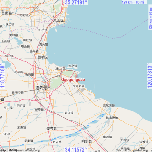
Gaogongdao GPS coordinates[2]
34° 41' 44.988" North, 119° 28' 30" East
| Map corner | latitude | longitude |
|---|---|---|
| Upper-left | 35.27191°, | 118.77188° |
| Center: | 34.69583°, | 119.475° |
| Lower-right: | 34.11572°, | 120.17813° |
| Map W x H: | 128.6×128.6 km | = 79.9×79.9mi |
| max Lat: | 53.31946° ⇑26.3% North |
| Gaogongdao: | 34.69583° |
| min Lat: | ⇓73.7% South 18.22056° |
| min Long | Gaogongdao | max Long |
| 75.07348° | 119.475° | 134.28917° |
| W 78.6%⇐ | ⇒21.4% E |
Elevation
Elevation of Gaogongdao is 80 m = 262 ft, and this is 404.8 m = 1328 ft below average elevation for this country.
| Max E: |
5622 m = 18445 ft | 63.5% |
| Avg. | 484.8 m = 1591 ft | |
| Gaogongdao | 80 m = 262 ft | |
Min E: |
-3 m = -10 ft | 36.5% |
See also: China elevation on elevation.city.
Geographical zone
Gaogongdao is located in North temperate zone (between Tropic of Cancer and the Arctic Circle). Distance of this Northern Tropic circle is 1251.9 km =777.9 mi to South.| Distance of | km | miles | from Gaogongdao |
|---|---|---|---|
| North Pole | 6149.2 | 3820.9 | to North |
| Arctic Circle | 3543.4 | 2201.8 | to North |
| Tropic Cancer | 1251.9 | 777.9 | to South |
| Equator | 3857.8 | 2397.1 | to South |


Nearby cities:
15 places around Gaogongdao: (largest is in red/bold)
• Banpu
32.3 km =20.1 mi,  220°
220°
• Chaoyang
16.3 km =10.1 mi,  264°
264°
• Huaguoshan
22.9 km =14.2 mi,  254°
254°
• Lianyun
5 km =3.1 mi,  323°
323°
• Lianyungang
26.1 km =16.2 mi, 245°
• Luoyang
33.7 km =20.9 mi,  272°
272°
• Nancheng
27.4 km =17 mi,  236°
236°
• Sidui
31 km =19.3 mi,  181°
181°
• Songzhuang
32.1 km =19.9 mi,  287°
287°
• Tongxing
31.8 km =19.8 mi,  192°
192°
• Xinpu
30.8 km =19.1 mi, 249°
• Xufeng
28.2 km =17.5 mi,  165°
165°
• Xuwei
19.7 km =12.2 mi,  163°
163°
• Yunshan
9.9 km =6.2 mi, 272°
• Zhongyun
7.9 km =4.9 mi,  230°
230°
Sources, notices
• [Note1] Compared only with cities in China existing in our database
• [Src1] Map data: © OpenStreetMap contributors (CC-BY-SA)
• [Src2] Other city data from geonames.org with taken over terms of usage.
• [Src3] Geographical zone / Annual Mean Temperature by Robert A. Rohde @ Wikipedia
