Xiyang geodata
Xiyang (Fujian) is a seat of a fourth-order administrative division; located in China in Asia/Shanghai (GMT+8) time zone. In our database, there are 1268 cities with bigger population. Compared to other cities in China, 83.1% of cities are located further ↑North; 68.5% of cities are located further ←West and 62.3% of cities have lower elevation than Xiyang. Note1


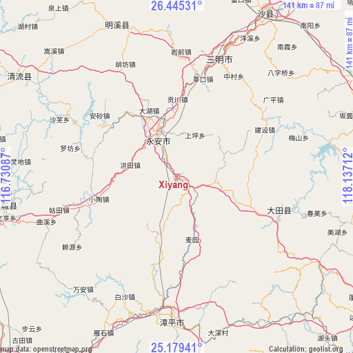
Xiyang GPS coordinates[2]
25° 48' 50.58" North, 117° 26' 2.364" East
| Map corner | latitude | longitude |
|---|---|---|
| Upper-left | 26.44531°, | 116.73087° |
| Center: | 25.81405°, | 117.43399° |
| Lower-right: | 25.17941°, | 118.13712° |
| Map W x H: | 140.8×140.8 km | = 87.5×87.5mi |
| max Lat: | 53.31946° ⇑83.1% North |
| Xiyang: | 25.81405° |
| min Lat: | ⇓16.9% South 18.22056° |
| min Long | Xiyang | max Long |
| 75.07348° | 117.43399° | 134.28917° |
| W 68.5%⇐ | ⇒31.5% E |
Elevation
Elevation of Xiyang is 287 m = 942 ft, and this is 197.8 m = 649 ft below average elevation for this country.
| Max E: |
5622 m = 18445 ft | 37.7% |
| Avg. | 484.8 m = 1591 ft | |
| Xiyang | 287 m = 942 ft | |
Min E: |
-3 m = -10 ft | 62.3% |
See also: China elevation on elevation.city.
Geographical zone
Xiyang is located in North temperate zone (between Tropic of Cancer and the Arctic Circle). Distance of this Northern Tropic circle is 264.3 km =164.2 mi to South.| Distance of | km | miles | from Xiyang |
|---|---|---|---|
| North Pole | 7136.8 | 4434.6 | to North |
| Arctic Circle | 4530.9 | 2815.4 | to North |
| Tropic Cancer | 264.3 | 164.2 | to South |
| Equator | 2870.3 | 1783.5 | to South |


Nearby cities:
15 places around Xiyang: (largest is in red/bold)
• Caoyuan
26.3 km =16.3 mi,  337°
337°
• Chishui
27.9 km =17.3 mi,  211°
211°
• Dahu
28.4 km =17.6 mi, 337°
• Gongchuan
30.9 km =19.2 mi,  0°
0°
• Hongtian
19.1 km =11.9 mi,  284°
284°
• Huangli
12.3 km =7.6 mi,  331°
331°
• Jishan
19.7 km =12.2 mi,  323°
323°
• Lingdi
27.6 km =17.1 mi,  146°
146°
• Shangjing
25.5 km =15.8 mi,  113°
113°
• Shangping
18.1 km =11.2 mi,  23°
23°
• Shuangyang
24.1 km =15 mi,  197°
197°
• Taihua
28.4 km =17.6 mi,  89°
89°
• Taoyuan
14.5 km =9 mi,  101°
101°
• Xinqiao
25.7 km =16 mi,  163°
163°
• Yong’an
19.7 km =12.2 mi, 339°
Sources, notices
• [Note1] Compared only with cities in China existing in our database
• [Src1] Map data: © OpenStreetMap contributors (CC-BY-SA)
• [Src2] Other city data from geonames.org with taken over terms of usage.
• [Src3] Geographical zone / Annual Mean Temperature by Robert A. Rohde @ Wikipedia
