Lingdi geodata
Lingdi (Fujian) is a seat of a fourth-order administrative division; located in China in Asia/Shanghai (GMT+8) time zone. In our database, there are 1268 cities with bigger population. Compared to other cities in China, 83.8% of cities are located further ↑North; 69.1% of cities are located further ←West and 73.2% of cities have lower elevation than Lingdi. Note1


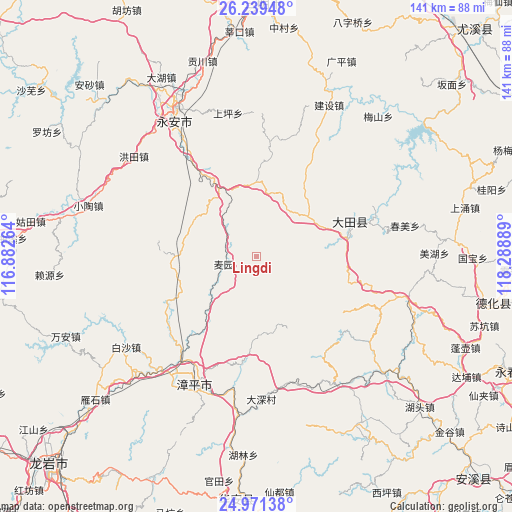
Lingdi GPS coordinates[2]
25° 36' 25.596" North, 117° 35' 8.736" East
| Map corner | latitude | longitude |
|---|---|---|
| Upper-left | 26.23948°, | 116.88264° |
| Center: | 25.60711°, | 117.58576° |
| Lower-right: | 24.97138°, | 118.28889° |
| Map W x H: | 141×141 km | = 87.6×87.6mi |
| max Lat: | 53.31946° ⇑83.8% North |
| Lingdi: | 25.60711° |
| min Lat: | ⇓16.2% South 18.22056° |
| min Long | Lingdi | max Long |
| 75.07348° | 117.58576° | 134.28917° |
| W 69.1%⇐ | ⇒30.9% E |
Elevation
Elevation of Lingdi is 479 m = 1572 ft, and this is 5.8 m = 19 ft below average elevation for this country.
| Max E: |
5622 m = 18445 ft | 26.8% |
| Avg. | 484.8 m = 1591 ft | |
| Lingdi | 479 m = 1572 ft | |
Min E: |
-3 m = -10 ft | 73.2% |
See also: China elevation on elevation.city.
Geographical zone
Lingdi is located in North temperate zone (between Tropic of Cancer and the Arctic Circle). Distance of this Northern Tropic circle is 241.3 km =149.9 mi to South.| Distance of | km | miles | from Lingdi |
|---|---|---|---|
| North Pole | 7159.8 | 4448.9 | to North |
| Arctic Circle | 4553.9 | 2829.7 | to North |
| Tropic Cancer | 241.3 | 149.9 | to South |
| Equator | 2847.2 | 1769.2 | to South |


Nearby cities:
15 places around Lingdi: (largest is in red/bold)
• Chishui
29.7 km =18.5 mi,  268°
268°
• Junxi
27.9 km =17.3 mi,  68°
68°
• Shangjing
15.2 km =9.4 mi,  32°
32°
• Shipai
25.1 km =15.6 mi,  77°
77°
• Shuangyang
22.6 km =14 mi, 270°
• Taihua
26.6 km =16.5 mi, 29°
• Taoyuan
20.1 km =12.5 mi,  357°
357°
• Wuci
6 km =3.7 mi,  100°
100°
• Wuling
13.3 km =8.3 mi, 78°
• Xianghu
21.2 km =13.2 mi,  168°
168°
• Xieyang
18.1 km =11.2 mi,  108°
108°
• Xinan
23.1 km =14.4 mi,  182°
182°
• Xinqiao
8.2 km =5.1 mi,  258°
258°
• Xiyang
27.6 km =17.1 mi,  326°
326°
• Yidu
27.8 km =17.3 mi,  126°
126°
Sources, notices
• [Note1] Compared only with cities in China existing in our database
• [Src1] Map data: © OpenStreetMap contributors (CC-BY-SA)
• [Src2] Other city data from geonames.org with taken over terms of usage.
• [Src3] Geographical zone / Annual Mean Temperature by Robert A. Rohde @ Wikipedia
