Xinyi geodata
Xinyi (Shaanxi) is a seat of a fourth-order administrative division; located in China in Asia/Shanghai (GMT+8) time zone. In our database, there are 1268 cities with bigger population. Compared to other cities in China, 73.1% of cities are located further ↓South; 73.4% of cities are located further →East and 66% of cities have lower elevation than Xinyi. Note1


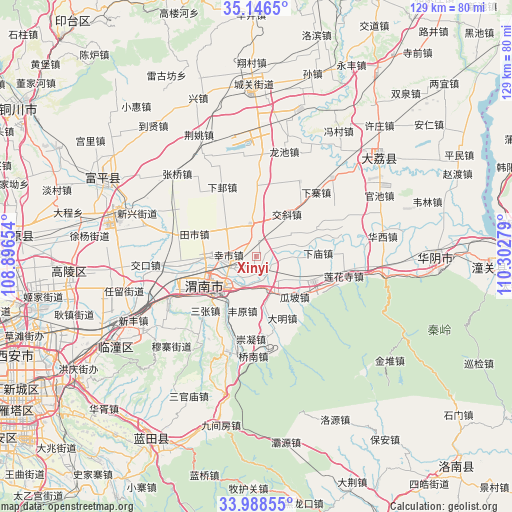
Xinyi GPS coordinates[2]
34° 34' 10.344" North, 109° 35' 58.776" East
| Map corner | latitude | longitude |
|---|---|---|
| Upper-left | 35.1465°, | 108.89654° |
| Center: | 34.56954°, | 109.59966° |
| Lower-right: | 33.98855°, | 110.30279° |
| Map W x H: | 128.8×128.8 km | = 80×80mi |
| max Lat: | 53.31946° ⇑26.9% North |
| Xinyi: | 34.56954° |
| min Lat: | ⇓73.1% South 18.22056° |
| min Long | Xinyi | max Long |
| 75.07348° | 109.59966° | 134.28917° |
| W 26.6%⇐ | ⇒73.4% E |
Elevation
Elevation of Xinyi is 343 m = 1125 ft, and this is 141.8 m = 465 ft below average elevation for this country.
| Max E: |
5622 m = 18445 ft | 34% |
| Avg. | 484.8 m = 1591 ft | |
| Xinyi | 343 m = 1125 ft | |
Min E: |
-3 m = -10 ft | 66% |
See also: China elevation on elevation.city.
Geographical zone
Xinyi is located in North temperate zone (between Tropic of Cancer and the Arctic Circle). Distance of this Northern Tropic circle is 1237.9 km =769.2 mi to South.| Distance of | km | miles | from Xinyi |
|---|---|---|---|
| North Pole | 6163.3 | 3829.7 | to North |
| Arctic Circle | 3557.4 | 2210.5 | to North |
| Tropic Cancer | 1237.9 | 769.2 | to South |
| Equator | 3843.8 | 2388.4 | to South |


Nearby cities:
15 places around Xinyi: (largest is in red/bold)
• Chishui
8 km =5 mi,  150°
150°
• Fengyuan
14.2 km =8.8 mi,  193°
193°
• Guandao
12.6 km =7.8 mi,  302°
302°
• Guapo
14.1 km =8.8 mi,  136°
136°
• Gushi
8.2 km =5.1 mi,  350°
350°
• Huazhou
15.7 km =9.8 mi,  112°
112°
• Jiaoxie
13.2 km =8.2 mi,  36°
36°
• Longbei
3.8 km =2.4 mi,  221°
221°
• Nanshi
9.4 km =5.8 mi,  15°
15°
• Shuangwang
11.1 km =6.9 mi,  244°
244°
• Weinan
11.1 km =6.9 mi,  228°
228°
• Xiamiao
15.7 km =9.8 mi,  87°
87°
• Xiaoyi
10.9 km =6.8 mi,  60°
60°
• Xinshi
6.9 km =4.3 mi,  272°
272°
• Zhangjia
13.5 km =8.4 mi,  67°
67°
Sources, notices
• [Note1] Compared only with cities in China existing in our database
• [Src1] Map data: © OpenStreetMap contributors (CC-BY-SA)
• [Src2] Other city data from geonames.org with taken over terms of usage.
• [Src3] Geographical zone / Annual Mean Temperature by Robert A. Rohde @ Wikipedia
