Guapo geodata
Guapo (Shaanxi) is a seat of a fourth-order administrative division; located in China in Asia/Shanghai (GMT+8) time zone. In our database, there are 1268 cities with bigger population. Compared to other cities in China, 72.6% of cities are located further ↓South; 72.8% of cities are located further →East and 69% of cities have lower elevation than Guapo. Note1


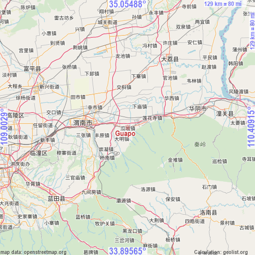
Guapo GPS coordinates[2]
34° 28' 38.208" North, 109° 42' 21.672" East
| Map corner | latitude | longitude |
|---|---|---|
| Upper-left | 35.05488°, | 109.0029° |
| Center: | 34.47728°, | 109.70602° |
| Lower-right: | 33.89565°, | 110.40915° |
| Map W x H: | 128.9×128.9 km | = 80.1×80.1mi |
| max Lat: | 53.31946° ⇑27.4% North |
| Guapo: | 34.47728° |
| min Lat: | ⇓72.6% South 18.22056° |
| min Long | Guapo | max Long |
| 75.07348° | 109.70602° | 134.28917° |
| W 27.2%⇐ | ⇒72.8% E |
Elevation
Elevation of Guapo is 393 m = 1289 ft, and this is 91.8 m = 301 ft below average elevation for this country.
| Max E: |
5622 m = 18445 ft | 31% |
| Avg. | 484.8 m = 1591 ft | |
| Guapo | 393 m = 1289 ft | |
Min E: |
-3 m = -10 ft | 69% |
See also: China elevation on elevation.city.
Geographical zone
Guapo is located in North temperate zone (between Tropic of Cancer and the Arctic Circle). Distance of this Northern Tropic circle is 1227.6 km =762.8 mi to South.| Distance of | km | miles | from Guapo |
|---|---|---|---|
| North Pole | 6173.5 | 3836 | to North |
| Arctic Circle | 3567.7 | 2216.9 | to North |
| Tropic Cancer | 1227.6 | 762.8 | to South |
| Equator | 3833.5 | 2382 | to South |


Nearby cities:
15 places around Guapo: (largest is in red/bold)
• Chishui
6.7 km =4.2 mi,  299°
299°
• Chongning
15.2 km =9.4 mi,  226°
226°
• Daming
6.2 km =3.9 mi,  210°
210°
• Dongyang
12.6 km =7.8 mi, 214°
• Fengyuan
13.5 km =8.4 mi,  254°
254°
• Gaotang
9.3 km =5.8 mi, 212°
• Huazhou
6.3 km =3.9 mi,  48°
48°
• Jinhui
5.2 km =3.2 mi,  186°
186°
• Lianhuasi
13.4 km =8.3 mi,  66°
66°
• Liuzhi
15.4 km =9.6 mi,  63°
63°
• Longbei
14.4 km =8.9 mi, 300°
• Xiamiao
12.5 km =7.8 mi,  28°
28°
• Xiaoyi
15.6 km =9.7 mi,  358°
358°
• Xinglin
5.3 km =3.3 mi, 69°
• Xinyi
14.1 km =8.8 mi,  316°
316°
Sources, notices
• [Note1] Compared only with cities in China existing in our database
• [Src1] Map data: © OpenStreetMap contributors (CC-BY-SA)
• [Src2] Other city data from geonames.org with taken over terms of usage.
• [Src3] Geographical zone / Annual Mean Temperature by Robert A. Rohde @ Wikipedia
