Jiaoxie geodata
Jiaoxie (Shaanxi) is a seat of a fourth-order administrative division; located in China in Asia/Shanghai (GMT+8) time zone. In our database, there are 1268 cities with bigger population. Compared to other cities in China, 73.6% of cities are located further ↓South; 72.9% of cities are located further →East and 66.5% of cities have lower elevation than Jiaoxie. Note1


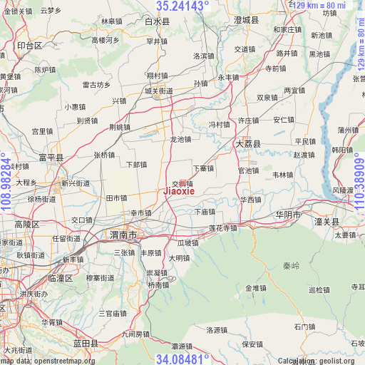
Jiaoxie GPS coordinates[2]
34° 39' 54.504" North, 109° 41' 9.456" East
| Map corner | latitude | longitude |
|---|---|---|
| Upper-left | 35.24143°, | 108.98284° |
| Center: | 34.66514°, | 109.68596° |
| Lower-right: | 34.08481°, | 110.38909° |
| Map W x H: | 128.6×128.6 km | = 79.9×79.9mi |
| max Lat: | 53.31946° ⇑26.4% North |
| Jiaoxie: | 34.66514° |
| min Lat: | ⇓73.6% South 18.22056° |
| min Long | Jiaoxie | max Long |
| 75.07348° | 109.68596° | 134.28917° |
| W 27.1%⇐ | ⇒72.9% E |
Elevation
Elevation of Jiaoxie is 352 m = 1155 ft, and this is 132.8 m = 436 ft below average elevation for this country.
| Max E: |
5622 m = 18445 ft | 33.5% |
| Avg. | 484.8 m = 1591 ft | |
| Jiaoxie | 352 m = 1155 ft | |
Min E: |
-3 m = -10 ft | 66.5% |
See also: China elevation on elevation.city.
Geographical zone
Jiaoxie is located in North temperate zone (between Tropic of Cancer and the Arctic Circle). Distance of this Northern Tropic circle is 1248.5 km =775.8 mi to South.| Distance of | km | miles | from Jiaoxie |
|---|---|---|---|
| North Pole | 6152.7 | 3823.1 | to North |
| Arctic Circle | 3546.8 | 2203.9 | to North |
| Tropic Cancer | 1248.5 | 775.8 | to South |
| Equator | 3854.4 | 2395 | to South |


Nearby cities:
15 places around Jiaoxie: (largest is in red/bold)
• Bijia
16.7 km =10.4 mi,  123°
123°
• Dangmu
17.6 km =10.9 mi,  340°
340°
• Guanlu
8.7 km =5.4 mi,  22°
22°
• Gushi
9.6 km =6 mi,  254°
254°
• Lindian
9.9 km =6.2 mi,  309°
309°
• Longbei
17.1 km =10.6 mi,  217°
217°
• Longchi
15.7 km =9.8 mi,  356°
356°
• Nanshi
5.5 km =3.4 mi, 253°
• Qiangbai
14.6 km =9.1 mi,  51°
51°
• Sucun
15.3 km =9.5 mi,  99°
99°
• Xiamiao
12.5 km =7.8 mi,  141°
141°
• Xiaoyi
5.5 km =3.4 mi,  163°
163°
• Xiazhai
9.1 km =5.7 mi, 52°
• Xinyi
13.2 km =8.2 mi, 216°
• Zhangjia
7 km =4.3 mi, 139°
Sources, notices
• [Note1] Compared only with cities in China existing in our database
• [Src1] Map data: © OpenStreetMap contributors (CC-BY-SA)
• [Src2] Other city data from geonames.org with taken over terms of usage.
• [Src3] Geographical zone / Annual Mean Temperature by Robert A. Rohde @ Wikipedia
