Xilai geodata
Xilai (Jiangsu) is a seat of a fourth-order administrative division; located in China in Asia/Shanghai (GMT+8) time zone. In our database, there are 1268 cities with bigger population. Compared to other cities in China, 61.9% of cities are located further ↓South; 84.6% of cities are located further ←West and 94.3% of cities have higher elevation than Xilai. Note1


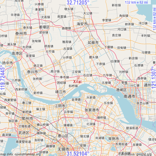
Xilai GPS coordinates[2]
32° 7' 6.564" North, 120° 25' 39.252" East
| Map corner | latitude | longitude |
|---|---|---|
| Upper-left | 32.71205°, | 119.72445° |
| Center: | 32.11849°, | 120.42757° |
| Lower-right: | 31.52104°, | 121.1307° |
| Map W x H: | 132.4×132.4 km | = 82.3×82.3mi |
| max Lat: | 53.31946° ⇑38.1% North |
| Xilai: | 32.11849° |
| min Lat: | ⇓61.9% South 18.22056° |
| min Long | Xilai | max Long |
| 75.07348° | 120.42757° | 134.28917° |
| W 84.6%⇐ | ⇒15.4% E |
Elevation
Elevation of Xilai is 7 m = 23 ft, and this is 477.8 m = 1568 ft below average elevation for this country.
| Max E: |
5622 m = 18445 ft | 94.3% |
| Avg. | 484.8 m = 1591 ft | |
| Xilai | 7 m = 23 ft | |
Min E: |
-3 m = -10 ft | 5.7% |
See also: China elevation on elevation.city.
Geographical zone
Xilai is located in North temperate zone (between Tropic of Cancer and the Arctic Circle). Distance of this Northern Tropic circle is 965.3 km =599.8 mi to South.| Distance of | km | miles | from Xilai |
|---|---|---|---|
| North Pole | 6435.8 | 3999 | to North |
| Arctic Circle | 3829.9 | 2379.8 | to North |
| Tropic Cancer | 965.3 | 599.8 | to South |
| Equator | 3571.2 | 2219 | to South |


Nearby cities:
15 places around Xilai: (largest is in red/bold)
• Changjiang
12.4 km =7.7 mi,  97°
97°
• Changqing
15.7 km =9.8 mi,  9°
9°
• Daxin
19.6 km =12.2 mi,  146°
146°
• Gaoming
15.6 km =9.7 mi,  340°
340°
• Guangling
18.1 km =11.2 mi,  265°
265°
• Guoyuan
16.6 km =10.3 mi,  71°
71°
• Gushan
13.3 km =8.3 mi,  244°
244°
• Jiang’an
6.4 km =4 mi, 344°
• Jingang
18.3 km =11.4 mi,  187°
187°
• Jingjiang
19.4 km =12.1 mi,  233°
233°
• Jishi
11.6 km =7.2 mi,  279°
279°
• Shanhu
12.3 km =7.6 mi,  303°
303°
• Shizhuang
9 km =5.6 mi, 69°
• Wuyao
14.6 km =9.1 mi,  48°
48°
• Xieqiao
7.6 km =4.7 mi,  213°
213°
Sources, notices
• [Note1] Compared only with cities in China existing in our database
• [Src1] Map data: © OpenStreetMap contributors (CC-BY-SA)
• [Src2] Other city data from geonames.org with taken over terms of usage.
• [Src3] Geographical zone / Annual Mean Temperature by Robert A. Rohde @ Wikipedia
