Daxin geodata
Daxin (Jiangsu) is a seat of a fourth-order administrative division; located in China in Asia/Shanghai (GMT+8) time zone. In our database, there are 1268 cities with bigger population. Compared to other cities in China, 61% of cities are located further ↓South; 85.3% of cities are located further ←West and 94.3% of cities have higher elevation than Daxin. Note1


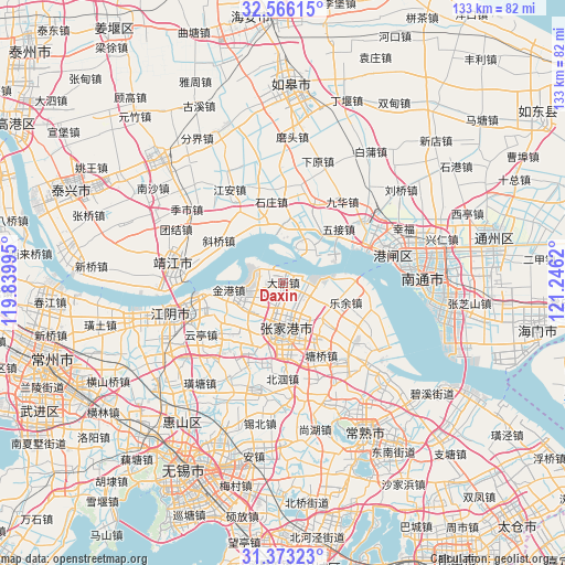
Daxin GPS coordinates[2]
31° 58' 17.868" North, 120° 32' 35.052" East
| Map corner | latitude | longitude |
|---|---|---|
| Upper-left | 32.56615°, | 119.83995° |
| Center: | 31.97163°, | 120.54307° |
| Lower-right: | 31.37323°, | 121.2462° |
| Map W x H: | 132.6×132.6 km | = 82.4×82.4mi |
| max Lat: | 53.31946° ⇑39% North |
| Daxin: | 31.97163° |
| min Lat: | ⇓61% South 18.22056° |
| min Long | Daxin | max Long |
| 75.07348° | 120.54307° | 134.28917° |
| W 85.3%⇐ | ⇒14.7% E |
Elevation
Elevation of Daxin is 7 m = 23 ft, and this is 477.8 m = 1568 ft below average elevation for this country.
| Max E: |
5622 m = 18445 ft | 94.3% |
| Avg. | 484.8 m = 1591 ft | |
| Daxin | 7 m = 23 ft | |
Min E: |
-3 m = -10 ft | 5.7% |
See also: China elevation on elevation.city.
Geographical zone
Daxin is located in North temperate zone (between Tropic of Cancer and the Arctic Circle). Distance of this Northern Tropic circle is 949 km =589.7 mi to South.| Distance of | km | miles | from Daxin |
|---|---|---|---|
| North Pole | 6452.1 | 4009.1 | to North |
| Arctic Circle | 3846.3 | 2390 | to North |
| Tropic Cancer | 949 | 589.7 | to South |
| Equator | 3554.9 | 2208.9 | to South |


Nearby cities:
15 places around Daxin: (largest is in red/bold)
• Changjiang
14.8 km =9.2 mi,  5°
5°
• Fenghuang
21.4 km =13.3 mi,  159°
159°
• Huashi
17 km =10.6 mi,  206°
206°
• Jinfeng
9.9 km =6.2 mi,  96°
96°
• Jingang
13.5 km =8.4 mi,  262°
262°
• Jiuhua
21.1 km =13.1 mi,  29°
29°
• Leyu
15.4 km =9.6 mi,  108°
108°
• Nanfeng
15.4 km =9.6 mi,  131°
131°
• Shizhuang
19.7 km =12.2 mi,  352°
352°
• Wujie
18.2 km =11.3 mi,  45°
45°
• Xieqiao
18.1 km =11.2 mi,  303°
303°
• Xilai
19.6 km =12.2 mi,  326°
326°
• Xinqiao
19.1 km =11.9 mi,  190°
190°
• Zhangjiagang
11.9 km =7.4 mi,  181°
181°
• Zhouzhuang
17.6 km =10.9 mi,  228°
228°
Sources, notices
• [Note1] Compared only with cities in China existing in our database
• [Src1] Map data: © OpenStreetMap contributors (CC-BY-SA)
• [Src2] Other city data from geonames.org with taken over terms of usage.
• [Src3] Geographical zone / Annual Mean Temperature by Robert A. Rohde @ Wikipedia
