Xiangong geodata
Xiangong (Shaanxi) is a seat of a fourth-order administrative division; located in China in Asia/Shanghai (GMT+8) time zone. In our database, there are 1268 cities with bigger population. Compared to other cities in China, 72.9% of cities are located further ↓South; 83.5% of cities are located further →East and 81% of cities have lower elevation than Xiangong. Note1


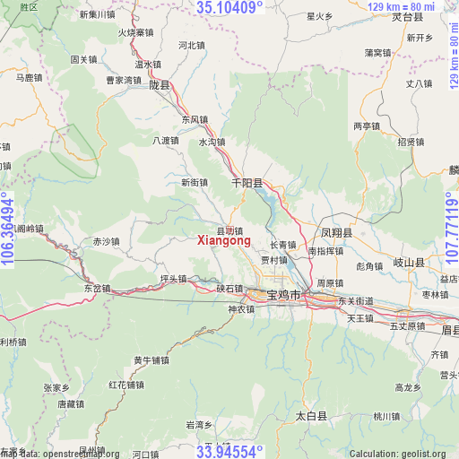
Xiangong GPS coordinates[2]
34° 31' 36.588" North, 107° 4' 5.016" East
| Map corner | latitude | longitude |
|---|---|---|
| Upper-left | 35.10409°, | 106.36494° |
| Center: | 34.52683°, | 107.06806° |
| Lower-right: | 33.94554°, | 107.77119° |
| Map W x H: | 128.8×128.8 km | = 80×80mi |
| max Lat: | 53.31946° ⇑27.1% North |
| Xiangong: | 34.52683° |
| min Lat: | ⇓72.9% South 18.22056° |
| min Long | Xiangong | max Long |
| 75.07348° | 107.06806° | 134.28917° |
| W 16.5%⇐ | ⇒83.5% E |
Elevation
Elevation of Xiangong is 741 m = 2431 ft, and this is 256.2 m = 841 ft above average elevation for this country.
| Max E: |
5622 m = 18445 ft | 19% |
| Xiangong | 741 m 2431 ft | |
| Avg. | 484.8 m = 1591 ft | |
Min E: |
-3 m = -10 ft | 81% |
See also: China elevation on elevation.city.
Geographical zone
Xiangong is located in North temperate zone (between Tropic of Cancer and the Arctic Circle). Distance of this Northern Tropic circle is 1233.1 km =766.2 mi to South.| Distance of | km | miles | from Xiangong |
|---|---|---|---|
| North Pole | 6168 | 3832.6 | to North |
| Arctic Circle | 3562.2 | 2213.4 | to North |
| Tropic Cancer | 1233.1 | 766.2 | to South |
| Equator | 3839 | 2385.4 | to South |


Nearby cities:
15 places around Xiangong: (largest is in red/bold)
• Cuijiatou
19.3 km =12 mi,  50°
50°
• Gaojia
18.5 km =11.5 mi,  180°
180°
• Jiacun
14.9 km =9.3 mi,  123°
123°
• Jinhe
11.1 km =6.9 mi,  148°
148°
• Jinling
19.1 km =11.9 mi,  156°
156°
• Lingyuan
14.7 km =9.1 mi, 161°
• Nanzhai
17.4 km =10.8 mi,  33°
33°
• Panlong
17 km =10.6 mi,  135°
135°
• Qianyang Chengguanzhen
14 km =8.7 mi,  23°
23°
• Qiaozhen
7.9 km =4.9 mi, 124°
• Shigou
18.9 km =11.7 mi,  356°
356°
• Shuangbaiyang
6.3 km =3.9 mi,  326°
326°
• Wenjiapo
19.4 km =12.1 mi, 18°
• Xiashixiang
16.3 km =10.1 mi, 179°
• Zhongshan Donglu
17.9 km =11.1 mi, 156°
Sources, notices
• [Note1] Compared only with cities in China existing in our database
• [Src1] Map data: © OpenStreetMap contributors (CC-BY-SA)
• [Src2] Other city data from geonames.org with taken over terms of usage.
• [Src3] Geographical zone / Annual Mean Temperature by Robert A. Rohde @ Wikipedia
