Xiashixiang geodata
Xiashixiang (Shaanxi) is a seat of a fourth-order administrative division; located in China in Asia/Shanghai (GMT+8) time zone. In our database, there are 1268 cities with bigger population. Compared to other cities in China, 72% of cities are located further ↓South; 83.5% of cities are located further →East and 80.4% of cities have lower elevation than Xiashixiang. Note1


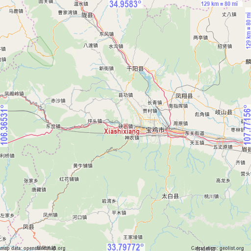
Xiashixiang GPS coordinates[2]
34° 22' 48.072" North, 107° 4' 6.348" East
| Map corner | latitude | longitude |
|---|---|---|
| Upper-left | 34.9583°, | 106.36531° |
| Center: | 34.38002°, | 107.06843° |
| Lower-right: | 33.79772°, | 107.77156° |
| Map W x H: | 129×129 km | = 80.2×80.2mi |
| max Lat: | 53.31946° ⇑28% North |
| Xiashixiang: | 34.38002° |
| min Lat: | ⇓72% South 18.22056° |
| min Long | Xiashixiang | max Long |
| 75.07348° | 107.06843° | 134.28917° |
| W 16.5%⇐ | ⇒83.5% E |
Elevation
Elevation of Xiashixiang is 717 m = 2352 ft, and this is 232.2 m = 762 ft above average elevation for this country.
| Max E: |
5622 m = 18445 ft | 19.6% |
| Xiashixiang | 717 m 2352 ft | |
| Avg. | 484.8 m = 1591 ft | |
Min E: |
-3 m = -10 ft | 80.4% |
See also: China elevation on elevation.city.
Geographical zone
Xiashixiang is located in North temperate zone (between Tropic of Cancer and the Arctic Circle). Distance of this Northern Tropic circle is 1216.8 km =756.1 mi to South.| Distance of | km | miles | from Xiashixiang |
|---|---|---|---|
| North Pole | 6184.4 | 3842.8 | to North |
| Arctic Circle | 3578.5 | 2223.6 | to North |
| Tropic Cancer | 1216.8 | 756.1 | to South |
| Equator | 3822.7 | 2375.3 | to South |


Nearby cities:
15 places around Xiashixiang: (largest is in red/bold)
• Baoji
15.5 km =9.6 mi,  95°
95°
• Bayu
19.7 km =12.2 mi, 104°
• Chencang
12.8 km =8 mi, 95°
• Gaojia
2.2 km =1.4 mi,  181°
181°
• Jiacun
14.9 km =9.3 mi,  56°
56°
• Jinhe
8.9 km =5.5 mi,  40°
40°
• Jinling
7.6 km =4.7 mi, 99°
• Lingyuan
5.2 km =3.2 mi, 63°
• Maying
15.3 km =9.5 mi,  106°
106°
• Panlong
12.6 km =7.8 mi,  70°
70°
• Qiaozhen
13.5 km =8.4 mi,  28°
28°
• Shennong
6.4 km =4 mi,  135°
135°
• Shigu
7.6 km =4.7 mi, 114°
• Xiangong
16.3 km =10.1 mi,  359°
359°
• Zhongshan Donglu
7.2 km =4.5 mi,  90°
90°
Sources, notices
• [Note1] Compared only with cities in China existing in our database
• [Src1] Map data: © OpenStreetMap contributors (CC-BY-SA)
• [Src2] Other city data from geonames.org with taken over terms of usage.
• [Src3] Geographical zone / Annual Mean Temperature by Robert A. Rohde @ Wikipedia
