Gaojia geodata
Gaojia (Shaanxi) is a seat of a fourth-order administrative division; located in China in Asia/Shanghai (GMT+8) time zone. In our database, there are 1268 cities with bigger population. Compared to other cities in China, 71.9% of cities are located further ↓South; 83.5% of cities are located further →East and 78.6% of cities have lower elevation than Gaojia. Note1


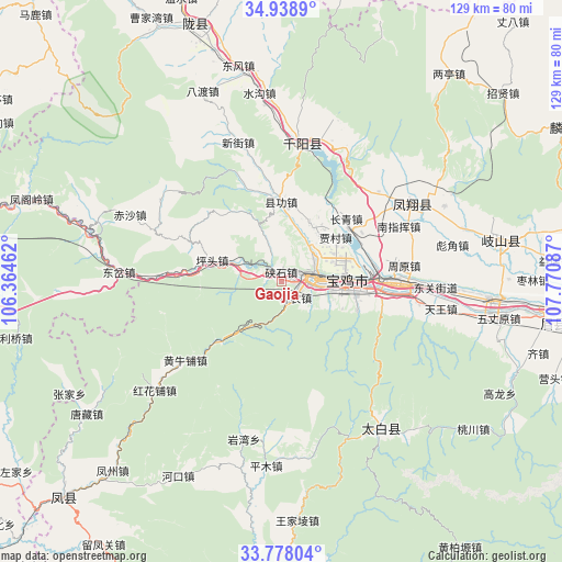
Gaojia GPS coordinates[2]
34° 21' 37.728" North, 107° 4' 3.864" East
| Map corner | latitude | longitude |
|---|---|---|
| Upper-left | 34.9389°, | 106.36462° |
| Center: | 34.36048°, | 107.06774° |
| Lower-right: | 33.77804°, | 107.77087° |
| Map W x H: | 129.1×129.1 km | = 80.2×80.2mi |
| max Lat: | 53.31946° ⇑28.1% North |
| Gaojia: | 34.36048° |
| min Lat: | ⇓71.9% South 18.22056° |
| min Long | Gaojia | max Long |
| 75.07348° | 107.06774° | 134.28917° |
| W 16.5%⇐ | ⇒83.5% E |
Elevation
Elevation of Gaojia is 636 m = 2087 ft, and this is 151.2 m = 496 ft above average elevation for this country.
| Max E: |
5622 m = 18445 ft | 21.4% |
| Gaojia | 636 m 2087 ft | |
| Avg. | 484.8 m = 1591 ft | |
Min E: |
-3 m = -10 ft | 78.6% |
See also: China elevation on elevation.city.
Geographical zone
Gaojia is located in North temperate zone (between Tropic of Cancer and the Arctic Circle). Distance of this Northern Tropic circle is 1214.6 km =754.7 mi to South.| Distance of | km | miles | from Gaojia |
|---|---|---|---|
| North Pole | 6186.5 | 3844.1 | to North |
| Arctic Circle | 3580.6 | 2224.9 | to North |
| Tropic Cancer | 1214.6 | 754.7 | to South |
| Equator | 3820.5 | 2373.9 | to South |


Nearby cities:
15 places around Gaojia: (largest is in red/bold)
• Baoji
15.6 km =9.7 mi,  87°
87°
• Bayu
19.4 km =12.1 mi,  97°
97°
• Chencang
12.9 km =8 mi, 85°
• Jiacun
16.2 km =10.1 mi,  50°
50°
• Jinhe
10.7 km =6.6 mi,  32°
32°
• Jinling
7.6 km =4.7 mi,  82°
82°
• Lingyuan
6.5 km =4 mi, 46°
• Maying
14.9 km =9.3 mi, 98°
• Panlong
13.6 km =8.5 mi,  61°
61°
• Qiaozhen
15.5 km =9.6 mi, 25°
• Shennong
5.1 km =3.2 mi,  117°
117°
• Shigu
7 km =4.3 mi, 98°
• Xiangong
18.5 km =11.5 mi,  0°
0°
• Xiashixiang
2.2 km =1.4 mi, 1°
• Zhongshan Donglu
7.5 km =4.7 mi,  73°
73°
Sources, notices
• [Note1] Compared only with cities in China existing in our database
• [Src1] Map data: © OpenStreetMap contributors (CC-BY-SA)
• [Src2] Other city data from geonames.org with taken over terms of usage.
• [Src3] Geographical zone / Annual Mean Temperature by Robert A. Rohde @ Wikipedia
