Wujiang geodata
Wujiang (Gansu) is a seat of a fourth-order administrative division; located in China in Asia/Shanghai (GMT+8) time zone. In our database, there are 1268 cities with bigger population. Compared to other cities in China, 82.8% of cities are located further ↓South; 94.2% of cities are located further →East and 90.9% of cities have lower elevation than Wujiang. Note1


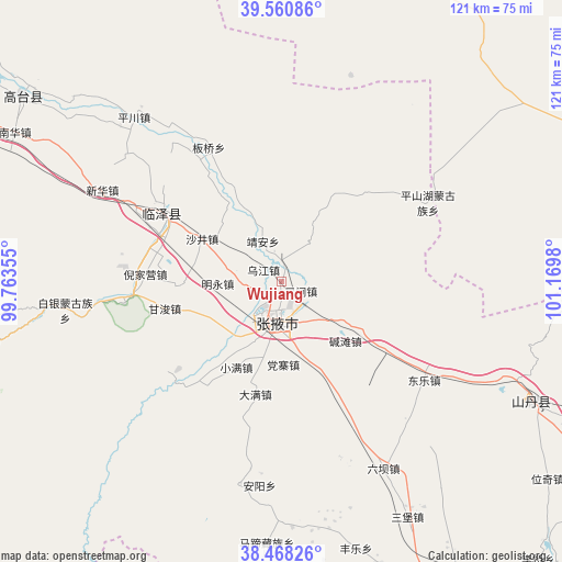
Wujiang GPS coordinates[2]
39° 1' 0.012" North, 100° 28' 0.012" East
| Map corner | latitude | longitude |
|---|---|---|
| Upper-left | 39.56086°, | 99.76355° |
| Center: | 39.01667°, | 100.46667° |
| Lower-right: | 38.46826°, | 101.1698° |
| Map W x H: | 121.5×121.5 km | = 75.5×75.5mi |
| max Lat: | 53.31946° ⇑17.2% North |
| Wujiang: | 39.01667° |
| min Lat: | ⇓82.8% South 18.22056° |
| min Long | Wujiang | max Long |
| 75.07348° | 100.46667° | 134.28917° |
| W 5.8%⇐ | ⇒94.2% E |
Elevation
Elevation of Wujiang is 1447 m = 4747 ft, and this is 962.2 m = 3157 ft above average elevation for this country.
| Max E: |
5622 m = 18445 ft | 9.1% |
| Wujiang | 1447 m 4747 ft | |
| Avg. | 484.8 m = 1591 ft | |
Min E: |
-3 m = -10 ft | 90.9% |
See also: China elevation on elevation.city.
Geographical zone
Wujiang is located in North temperate zone (between Tropic of Cancer and the Arctic Circle). Distance of this Northern Tropic circle is 1732.3 km =1076.4 mi to South.| Distance of | km | miles | from Wujiang |
|---|---|---|---|
| North Pole | 5668.8 | 3522.4 | to North |
| Arctic Circle | 3062.9 | 1903.2 | to North |
| Tropic Cancer | 1732.3 | 1076.4 | to South |
| Equator | 4338.2 | 2695.6 | to South |


Nearby cities:
15 places around Wujiang: (largest is in red/bold)
• Banqiao
33.6 km =20.9 mi,  337°
337°
• Daman
21.8 km =13.5 mi,  191°
191°
• Dongle
35.6 km =22.1 mi,  126°
126°
• Ganjun
26.3 km =16.3 mi,  257°
257°
• Huazhai
44.9 km =27.9 mi, 192°
• Jing’an
10.9 km =6.8 mi,  333°
333°
• Liuba
46.4 km =28.8 mi,  151°
151°
• Longqu
25.6 km =15.9 mi,  215°
215°
• Nanjie
6.9 km =4.3 mi,  175°
175°
• Pingshanhu
35.3 km =21.9 mi,  62°
62°
• Sanzha
2.7 km =1.7 mi,  123°
123°
• Shahe
28.5 km =17.7 mi,  299°
299°
• Shajing
19.6 km =12.2 mi, 298°
• Xinhua
45.1 km =28 mi, 296°
• Zhangye
9.3 km =5.8 mi, 188°
Sources, notices
• [Note1] Compared only with cities in China existing in our database
• [Src1] Map data: © OpenStreetMap contributors (CC-BY-SA)
• [Src2] Other city data from geonames.org with taken over terms of usage.
• [Src3] Geographical zone / Annual Mean Temperature by Robert A. Rohde @ Wikipedia
