Wudian geodata
Wudian (Hubei) is a seat of a fourth-order administrative division; located in China in Asia/Shanghai (GMT+8) time zone. In our database, there are 1268 cities with bigger population. Compared to other cities in China, 61.1% of cities are located further ↓South; 58.8% of cities are located further →East and 58.4% of cities have higher elevation than Wudian. Note1


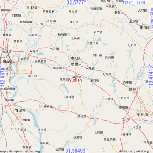
Wudian GPS coordinates[2]
31° 58' 59.7" North, 112° 46' 15.672" East
| Map corner | latitude | longitude |
|---|---|---|
| Upper-left | 32.5777°, | 112.0679° |
| Center: | 31.98325°, | 112.77102° |
| Lower-right: | 31.38493°, | 113.47415° |
| Map W x H: | 132.6×132.6 km | = 82.4×82.4mi |
| max Lat: | 53.31946° ⇑38.9% North |
| Wudian: | 31.98325° |
| min Lat: | ⇓61.1% South 18.22056° |
| min Long | Wudian | max Long |
| 75.07348° | 112.77102° | 134.28917° |
| W 41.2%⇐ | ⇒58.8% E |
Elevation
Elevation of Wudian is 109 m = 358 ft, and this is 375.8 m = 1233 ft below average elevation for this country.
| Max E: |
5622 m = 18445 ft | 58.4% |
| Avg. | 484.8 m = 1591 ft | |
| Wudian | 109 m = 358 ft | |
Min E: |
-3 m = -10 ft | 41.6% |
See also: China elevation on elevation.city.
Geographical zone
Wudian is located in North temperate zone (between Tropic of Cancer and the Arctic Circle). Distance of this Northern Tropic circle is 950.3 km =590.5 mi to South.| Distance of | km | miles | from Wudian |
|---|---|---|---|
| North Pole | 6450.9 | 4008.4 | to North |
| Arctic Circle | 3845 | 2389.2 | to North |
| Tropic Cancer | 950.3 | 590.5 | to South |
| Equator | 3556.2 | 2209.7 | to South |


Nearby cities:
15 places around Wudian: (largest is in red/bold)
• Dongxiang
31.1 km =19.3 mi,  299°
299°
• Huanglong
29.7 km =18.5 mi,  267°
267°
• Juwan
18.6 km =11.6 mi,  294°
294°
• Liusheng
25.8 km =16 mi,  43°
43°
• Lutou
32.8 km =20.4 mi,  27°
27°
• Pinglin
18.6 km =11.6 mi,  198°
198°
• Qifang
31.4 km =19.5 mi,  321°
321°
• Taiping
33.8 km =21 mi,  357°
357°
• Tangxian
32.4 km =20.1 mi,  90°
90°
• Wangcheng
15.8 km =9.8 mi,  100°
100°
• Wushan
33.1 km =20.6 mi,  58°
58°
• Xinglong
14.5 km =9 mi, 59°
• Xiongji
11.4 km =7.1 mi,  254°
254°
• Zaoyang
16.1 km =10 mi,  354°
354°
• Zhangjiaji
34.3 km =21.3 mi, 293°
Sources, notices
• [Note1] Compared only with cities in China existing in our database
• [Src1] Map data: © OpenStreetMap contributors (CC-BY-SA)
• [Src2] Other city data from geonames.org with taken over terms of usage.
• [Src3] Geographical zone / Annual Mean Temperature by Robert A. Rohde @ Wikipedia
