Lutou geodata
Lutou (Hubei) is a seat of a fourth-order administrative division; located in China in Asia/Shanghai (GMT+8) time zone. In our database, there are 1268 cities with bigger population. Compared to other cities in China, 62.7% of cities are located further ↓South; 57.9% of cities are located further →East and 50% of cities have lower elevation than Lutou. Note1


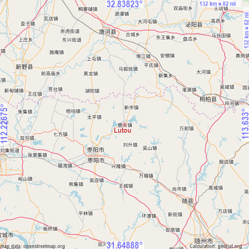
Lutou GPS coordinates[2]
32° 14' 43.8" North, 112° 55' 47.532" East
| Map corner | latitude | longitude |
|---|---|---|
| Upper-left | 32.83823°, | 112.22675° |
| Center: | 32.2455°, | 112.92987° |
| Lower-right: | 31.64888°, | 113.633° |
| Map W x H: | 132.2×132.2 km | = 82.1×82.1mi |
| max Lat: | 53.31946° ⇑37.3% North |
| Lutou: | 32.2455° |
| min Lat: | ⇓62.7% South 18.22056° |
| min Long | Lutou | max Long |
| 75.07348° | 112.92987° | 134.28917° |
| W 42.1%⇐ | ⇒57.9% E |
Elevation
Elevation of Lutou is 165 m = 541 ft, and this is 319.8 m = 1049 ft below average elevation for this country.
| Max E: |
5622 m = 18445 ft | 50% |
| Avg. | 484.8 m = 1591 ft | |
| Lutou | 165 m = 541 ft | |
Min E: |
-3 m = -10 ft | 50% |
See also: China elevation on elevation.city.
Geographical zone
Lutou is located in North temperate zone (between Tropic of Cancer and the Arctic Circle). Distance of this Northern Tropic circle is 979.4 km =608.6 mi to South.| Distance of | km | miles | from Lutou |
|---|---|---|---|
| North Pole | 6421.7 | 3990.3 | to North |
| Arctic Circle | 3815.8 | 2371 | to North |
| Tropic Cancer | 979.4 | 608.6 | to South |
| Equator | 3585.4 | 2227.9 | to South |


Nearby cities:
15 places around Lutou: (largest is in red/bold)
• Fujia
32.6 km =20.3 mi,  111°
111°
• Juwan
38.5 km =23.9 mi,  235°
235°
• Liusheng
10.8 km =6.7 mi,  164°
164°
• Qifang
34.8 km =21.6 mi,  262°
262°
• Taiping
16.9 km =10.5 mi,  285°
285°
• Tangxian
34.3 km =21.3 mi,  149°
149°
• Wangcheng
32 km =19.9 mi,  178°
178°
• Wanhe
32.8 km =20.4 mi,  92°
92°
• Wudian
32.8 km =20.4 mi,  207°
207°
• Wushan
17.9 km =11.1 mi,  132°
132°
• Xincheng
27.5 km =17.1 mi,  65°
65°
• Xinglong
22 km =13.7 mi,  186°
186°
• Xinshi
10.4 km =6.5 mi,  18°
18°
• Yangdang
28.6 km =17.8 mi, 285°
• Zaoyang
21.1 km =13.1 mi,  231°
231°
Sources, notices
• [Note1] Compared only with cities in China existing in our database
• [Src1] Map data: © OpenStreetMap contributors (CC-BY-SA)
• [Src2] Other city data from geonames.org with taken over terms of usage.
• [Src3] Geographical zone / Annual Mean Temperature by Robert A. Rohde @ Wikipedia
