Wucheng geodata
Wucheng (Anhui) is a seat of a fourth-order administrative division; located in China in Asia/Shanghai (GMT+8) time zone. With population of 60,212 people, there are 727 cities with bigger population in this country. Compared to other cities in China, 58.6% of cities are located further ↑North; 71.4% of cities are located further ←West and 52.1% of cities have higher elevation than Wucheng. Note1


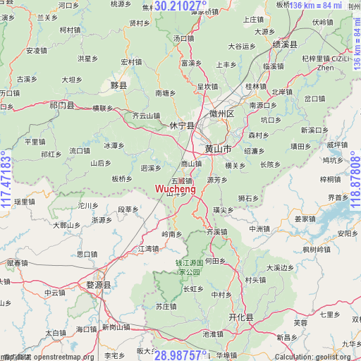
Wucheng GPS coordinates[2]
29° 36' 2.772" North, 118° 10' 29.82" East
| Map corner | latitude | longitude |
|---|---|---|
| Upper-left | 30.21027°, | 117.47183° |
| Center: | 29.60077°, | 118.17495° |
| Lower-right: | 28.98757°, | 118.87808° |
| Map W x H: | 136×136 km | = 84.5×84.5mi |
| max Lat: | 53.31946° ⇑58.6% North |
| Wucheng: | 29.60077° |
| min Lat: | ⇓41.4% South 18.22056° |
| min Long | Wucheng | max Long |
| 75.07348° | 118.17495° | 134.28917° |
| W 71.4%⇐ | ⇒28.6% E |
Elevation
Elevation of Wucheng is 149 m = 489 ft, and this is 335.8 m = 1102 ft below average elevation for this country.
| Max E: |
5622 m = 18445 ft | 52.1% |
| Avg. | 484.8 m = 1591 ft | |
| Wucheng | 149 m = 489 ft | |
Min E: |
-3 m = -10 ft | 47.9% |
See also: Wucheng elevation on elevation.city.
Geographical zone
Wucheng is located in North temperate zone (between Tropic of Cancer and the Arctic Circle). Distance of this Northern Tropic circle is 685.4 km =425.9 mi to South.| Distance of | km | miles | from Wucheng |
|---|---|---|---|
| North Pole | 6715.8 | 4173 | to North |
| Arctic Circle | 4109.9 | 2553.8 | to North |
| Tropic Cancer | 685.4 | 425.9 | to South |
| Equator | 3291.3 | 2045.1 | to South |


Nearby cities:
15 places around Wucheng: (largest is in red/bold)
• Banqiao
21.9 km =13.6 mi,  273°
273°
• Donglinxi
14 km =8.7 mi,  53°
53°
• Duanshen
22.4 km =13.9 mi,  241°
241°
• Haiyang
20.6 km =12.8 mi,  0°
0°
• Huangshan
18.1 km =11.2 mi, 47°
• Jiangtan
23.4 km =14.5 mi,  296°
296°
• Liyang
15.9 km =9.9 mi,  42°
42°
• Shichuan
17.8 km =11.1 mi,  182°
182°
• Wan’an
21.6 km =13.4 mi,  10°
10°
• Xikou
18.6 km =11.6 mi, 300°
• Xintan
18.2 km =11.3 mi,  34°
34°
• Xitou
18.8 km =11.7 mi,  209°
209°
• Yanghu
16.9 km =10.5 mi, 47°
• Yiqi
16.1 km =10 mi, 29°
• Zhengwan
19.1 km =11.9 mi,  77°
77°
Sources, notices
• [Note1] Compared only with cities in China existing in our database
• [Src1] Map data: © OpenStreetMap contributors (CC-BY-SA)
• [Src2] Other city data from geonames.org with taken over terms of usage.
• [Src3] Geographical zone / Annual Mean Temperature by Robert A. Rohde @ Wikipedia
