Wengang geodata
Wengang (Jiangxi) is a seat of a fourth-order administrative division; located in China in Asia/Shanghai (GMT+8) time zone. In our database, there are 1268 cities with bigger population. Compared to other cities in China, 71.6% of cities are located further ↑North; 60.7% of cities are located further ←West and 78.3% of cities have higher elevation than Wengang. Note1


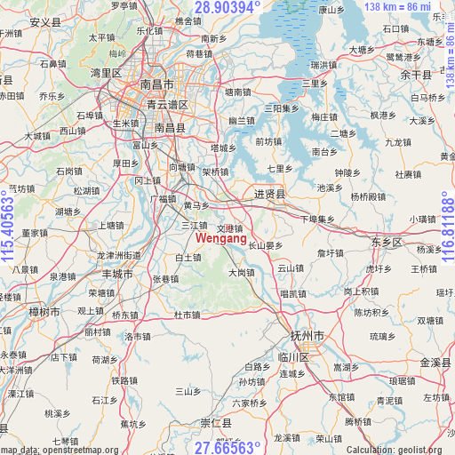
Wengang GPS coordinates[2]
28° 17' 11.724" North, 116° 6' 31.5" East
| Map corner | latitude | longitude |
|---|---|---|
| Upper-left | 28.90394°, | 115.40563° |
| Center: | 28.28659°, | 116.10875° |
| Lower-right: | 27.66563°, | 116.81188° |
| Map W x H: | 137.7×137.7 km | = 85.6×85.6mi |
| max Lat: | 53.31946° ⇑71.6% North |
| Wengang: | 28.28659° |
| min Lat: | ⇓28.4% South 18.22056° |
| min Long | Wengang | max Long |
| 75.07348° | 116.10875° | 134.28917° |
| W 60.7%⇐ | ⇒39.3% E |
Elevation
Elevation of Wengang is 30 m = 98 ft, and this is 454.8 m = 1492 ft below average elevation for this country.
| Max E: |
5622 m = 18445 ft | 78.3% |
| Avg. | 484.8 m = 1591 ft | |
| Wengang | 30 m = 98 ft | |
Min E: |
-3 m = -10 ft | 21.7% |
See also: China elevation on elevation.city.
Geographical zone
Wengang is located in North temperate zone (between Tropic of Cancer and the Arctic Circle). Distance of this Northern Tropic circle is 539.3 km =335.1 mi to South.| Distance of | km | miles | from Wengang |
|---|---|---|---|
| North Pole | 6861.9 | 4263.8 | to North |
| Arctic Circle | 4256 | 2644.6 | to North |
| Tropic Cancer | 539.3 | 335.1 | to South |
| Equator | 3145.2 | 1954.3 | to South |


Nearby cities:
15 places around Wengang: (largest is in red/bold)
• Baitu
15.1 km =9.4 mi,  234°
234°
• Baixu
14.3 km =8.9 mi,  101°
101°
• Changshanyan
12.3 km =7.6 mi,  114°
114°
• Dagang
16 km =9.9 mi,  156°
156°
• Duantan
15.4 km =9.6 mi,  262°
262°
• Huangma
11.9 km =7.4 mi,  307°
307°
• Liduzhen
8.4 km =5.2 mi,  146°
146°
• Luoxi
14.8 km =9.2 mi,  16°
16°
• Qili
23.8 km =14.8 mi,  41°
41°
• Quanling
10.8 km =6.7 mi,  340°
340°
• Sanjiang
10.2 km =6.3 mi,  273°
273°
• Xiangtang
21.1 km =13.1 mi,  317°
317°
• Xiaotang
21.1 km =13.1 mi,  245°
245°
• Yuandu
6.5 km =4 mi, 247°
• Yunshan
22.4 km =13.9 mi,  123°
123°
Sources, notices
• [Note1] Compared only with cities in China existing in our database
• [Src1] Map data: © OpenStreetMap contributors (CC-BY-SA)
• [Src2] Other city data from geonames.org with taken over terms of usage.
• [Src3] Geographical zone / Annual Mean Temperature by Robert A. Rohde @ Wikipedia
