Weicun geodata
Weicun (Jiangsu) is a seat of a fourth-order administrative division; located in China in Asia/Shanghai (GMT+8) time zone. In our database, there are 1268 cities with bigger population. Compared to other cities in China, 61% of cities are located further ↓South; 81.4% of cities are located further ←West and 89.9% of cities have higher elevation than Weicun. Note1


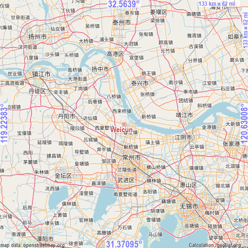
Weicun GPS coordinates[2]
31° 58' 9.696" North, 119° 55' 37.02" East
| Map corner | latitude | longitude |
|---|---|---|
| Upper-left | 32.5639°, | 119.22383° |
| Center: | 31.96936°, | 119.92695° |
| Lower-right: | 31.37095°, | 120.63008° |
| Map W x H: | 132.6×132.6 km | = 82.4×82.4mi |
| max Lat: | 53.31946° ⇑39% North |
| Weicun: | 31.96936° |
| min Lat: | ⇓61% South 18.22056° |
| min Long | Weicun | max Long |
| 75.07348° | 119.92695° | 134.28917° |
| W 81.4%⇐ | ⇒18.6% E |
Elevation
Elevation of Weicun is 10 m = 33 ft, and this is 474.8 m = 1558 ft below average elevation for this country.
| Max E: |
5622 m = 18445 ft | 89.9% |
| Avg. | 484.8 m = 1591 ft | |
| Weicun | 10 m = 33 ft | |
Min E: |
-3 m = -10 ft | 10.1% |
See also: China elevation on elevation.city.
Geographical zone
Weicun is located in North temperate zone (between Tropic of Cancer and the Arctic Circle). Distance of this Northern Tropic circle is 948.7 km =589.5 mi to South.| Distance of | km | miles | from Weicun |
|---|---|---|---|
| North Pole | 6452.4 | 4009.3 | to North |
| Arctic Circle | 3846.5 | 2390.1 | to North |
| Tropic Cancer | 948.7 | 589.5 | to South |
| Equator | 3554.7 | 2208.8 | to South |


Nearby cities:
15 places around Weicun: (largest is in red/bold)
• Baizhang
6.6 km =4.1 mi,  141°
141°
• Chunjiang
6.1 km =3.8 mi,  113°
113°
• Huangtu
14.8 km =9.2 mi, 135°
• Jianghua
13.9 km =8.6 mi,  33°
33°
• Jiepai
13.4 km =8.3 mi,  328°
328°
• Longhutang
13.8 km =8.6 mi,  158°
158°
• Luoxi
13.7 km =8.5 mi,  238°
238°
• Menghe
9 km =5.6 mi,  305°
305°
• Qixu
10.5 km =6.5 mi,  52°
52°
• Shizhuang
10.8 km =6.7 mi,  121°
121°
• Xilaiqiao
7.6 km =4.7 mi,  350°
350°
• Xinqiao
12 km =7.5 mi,  167°
167°
• Xinqiao
13.8 km =8.6 mi,  73°
73°
• Xixiashu
10.3 km =6.4 mi,  258°
258°
• Xuejia
12.1 km =7.5 mi,  185°
185°
Sources, notices
• [Note1] Compared only with cities in China existing in our database
• [Src1] Map data: © OpenStreetMap contributors (CC-BY-SA)
• [Src2] Other city data from geonames.org with taken over terms of usage.
• [Src3] Geographical zone / Annual Mean Temperature by Robert A. Rohde @ Wikipedia
