Taochuan geodata
Taochuan (Shaanxi) is a seat of a fourth-order administrative division; located in China in Asia/Shanghai (GMT+8) time zone. In our database, there are 1268 cities with bigger population. Compared to other cities in China, 70.3% of cities are located further ↓South; 82% of cities are located further →East and 87.6% of cities have lower elevation than Taochuan. Note1


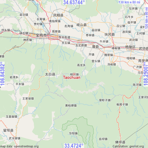
Taochuan GPS coordinates[2]
34° 3' 24.912" North, 107° 32' 48.984" East
| Map corner | latitude | longitude |
|---|---|---|
| Upper-left | 34.63744°, | 106.84382° |
| Center: | 34.05692°, | 107.54694° |
| Lower-right: | 33.4724°, | 108.25007° |
| Map W x H: | 129.5×129.5 km | = 80.5×80.5mi |
| max Lat: | 53.31946° ⇑29.7% North |
| Taochuan: | 34.05692° |
| min Lat: | ⇓70.3% South 18.22056° |
| min Long | Taochuan | max Long |
| 75.07348° | 107.54694° | 134.28917° |
| W 18%⇐ | ⇒82% E |
Elevation
Elevation of Taochuan is 1157 m = 3796 ft, and this is 672.2 m = 2205 ft above average elevation for this country.
| Max E: |
5622 m = 18445 ft | 12.4% |
| Taochuan | 1157 m 3796 ft | |
| Avg. | 484.8 m = 1591 ft | |
Min E: |
-3 m = -10 ft | 87.6% |
See also: China elevation on elevation.city.
Geographical zone
Taochuan is located in North temperate zone (between Tropic of Cancer and the Arctic Circle). Distance of this Northern Tropic circle is 1180.9 km =733.8 mi to South.| Distance of | km | miles | from Taochuan |
|---|---|---|---|
| North Pole | 6220.3 | 3865.1 | to North |
| Arctic Circle | 3614.4 | 2245.9 | to North |
| Tropic Cancer | 1180.9 | 733.8 | to South |
| Equator | 3786.8 | 2353 | to South |


Nearby cities:
15 places around Taochuan: (largest is in red/bold)
• Anle
21.1 km =13.1 mi,  29°
29°
• Caijiapo
30.4 km =18.9 mi,  8°
8°
• Caojia
21.6 km =13.4 mi, 14°
• Diaowei
26.1 km =16.2 mi,  353°
353°
• Jinqu
27.4 km =17 mi,  51°
51°
• Qizhen
23 km =14.3 mi,  41°
41°
• Shoushan
30.6 km =19 mi, 36°
• Tangyu
31.7 km =19.7 mi,  71°
71°
• Tianwang
28.1 km =17.5 mi, 345°
• Wuzhangyuan
26 km =16.2 mi, 13°
• Xiaofayi
28.2 km =17.5 mi,  63°
63°
• Yangping
31.7 km =19.7 mi, 350°
• Yingge
10.3 km =6.4 mi, 65°
• Yingtou
22.2 km =13.8 mi, 58°
• Zuitou
21.6 km =13.4 mi,  271°
271°
Sources, notices
• [Note1] Compared only with cities in China existing in our database
• [Src1] Map data: © OpenStreetMap contributors (CC-BY-SA)
• [Src2] Other city data from geonames.org with taken over terms of usage.
• [Src3] Geographical zone / Annual Mean Temperature by Robert A. Rohde @ Wikipedia
