Tangpeng geodata
Tangpeng (Guangdong) is a seat of a fourth-order administrative division; located in China in Asia/Urumqi (GMT+6) time zone. In our database, there are 1268 cities with bigger population. Compared to other cities in China, 97.6% of cities are located further ↑North; 70.7% of cities are located further →East and 67.2% of cities have higher elevation than Tangpeng. Note1


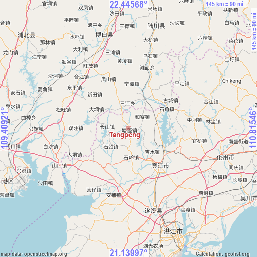
Tangpeng GPS coordinates[2]
21° 47' 39.516" North, 110° 6' 44.388" East
| Map corner | latitude | longitude |
|---|---|---|
| Upper-left | 22.44568°, | 109.40921° |
| Center: | 21.79431°, | 110.11233° |
| Lower-right: | 21.13997°, | 110.81546° |
| Map W x H: | 145.2×145.2 km | = 90.2×90.2mi |
| max Lat: | 53.31946° ⇑97.6% North |
| Tangpeng: | 21.79431° |
| min Lat: | ⇓2.4% South 18.22056° |
| min Long | Tangpeng | max Long |
| 75.07348° | 110.11233° | 134.28917° |
| W 29.3%⇐ | ⇒70.7% E |
Elevation
Elevation of Tangpeng is 64 m = 210 ft, and this is 420.8 m = 1381 ft below average elevation for this country.
| Max E: |
5622 m = 18445 ft | 67.2% |
| Avg. | 484.8 m = 1591 ft | |
| Tangpeng | 64 m = 210 ft | |
Min E: |
-3 m = -10 ft | 32.8% |
See also: China elevation on elevation.city.
Geographical zone
Tangpeng is located in North Torrid zone (between Equator and Tropic of Cancer). Distance of this Northern Tropic circle is 182.6 km =113.5 mi to North.| Distance of | km | miles | from Tangpeng |
|---|---|---|---|
| North Pole | 7583.8 | 4712.4 | to North |
| Arctic Circle | 4977.9 | 3093.1 | to North |
| Tropic Cancer | 182.6 | 113.5 | to North |
| Equator | 2423.3 | 1505.8 | to South |


Nearby cities:
15 places around Tangpeng: (largest is in red/bold)
• Changshan
11.1 km =6.9 mi,  271°
271°
• Hechun
22.2 km =13.8 mi,  118°
118°
• Heliao
10.6 km =6.6 mi,  49°
49°
• Hengshan
35.9 km =22.3 mi,  187°
187°
• Jishui
19.2 km =11.9 mi,  134°
134°
• Lianjiang
24 km =14.9 mi, 133°
• Luozhou
27 km =16.8 mi,  140°
140°
• Qingping
27.5 km =17.1 mi,  226°
226°
• Shicheng
27.5 km =17.1 mi, 142°
• Shijiao
22.5 km =14 mi,  65°
65°
• Shijing
14.1 km =8.8 mi,  220°
220°
• Shiling
16 km =9.9 mi,  174°
174°
• Xinmin
31.1 km =19.3 mi,  164°
164°
• Xin’an
36.6 km =22.7 mi, 116°
• Yatang
21.5 km =13.4 mi,  199°
199°
Sources, notices
• [Note1] Compared only with cities in China existing in our database
• [Src1] Map data: © OpenStreetMap contributors (CC-BY-SA)
• [Src2] Other city data from geonames.org with taken over terms of usage.
• [Src3] Geographical zone / Annual Mean Temperature by Robert A. Rohde @ Wikipedia
