Tangchijie geodata
Tangchijie (Yunnan) is a seat of a fourth-order administrative division; located in China in Asia/Shanghai (GMT+8) time zone. In our database, there are 1268 cities with bigger population. Compared to other cities in China, 86.5% of cities are located further ↑North; 91.5% of cities are located further →East and 93.5% of cities have lower elevation than Tangchijie. Note1


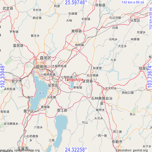
Tangchijie GPS coordinates[2]
24° 57' 42.012" North, 103° 2' 0.996" East
| Map corner | latitude | longitude |
|---|---|---|
| Upper-left | 25.59746°, | 102.33049° |
| Center: | 24.96167°, | 103.03361° |
| Lower-right: | 24.32258°, | 103.73674° |
| Map W x H: | 141.8×141.8 km | = 88.1×88.1mi |
| max Lat: | 53.31946° ⇑86.5% North |
| Tangchijie: | 24.96167° |
| min Lat: | ⇓13.5% South 18.22056° |
| min Long | Tangchijie | max Long |
| 75.07348° | 103.03361° | 134.28917° |
| W 8.5%⇐ | ⇒91.5% E |
Elevation
Elevation of Tangchijie is 1786 m = 5860 ft, and this is 1301.2 m = 4269 ft above average elevation for this country.
| Max E: |
5622 m = 18445 ft | 6.5% |
| Tangchijie | 1786 m 5860 ft | |
| Avg. | 484.8 m = 1591 ft | |
Min E: |
-3 m = -10 ft | 93.5% |
See also: China elevation on elevation.city.
Geographical zone
Tangchijie is located in North temperate zone (between Tropic of Cancer and the Arctic Circle). Distance of this Northern Tropic circle is 169.6 km =105.4 mi to South.| Distance of | km | miles | from Tangchijie |
|---|---|---|---|
| North Pole | 7231.6 | 4493.5 | to North |
| Arctic Circle | 4625.7 | 2874.3 | to North |
| Tropic Cancer | 169.6 | 105.4 | to South |
| Equator | 2775.5 | 1724.6 | to South |


Nearby cities:
15 places around Tangchijie: (largest is in red/bold)
• Ala
25.1 km =15.6 mi,  279°
279°
• Beigucheng
15.1 km =9.4 mi,  80°
80°
• Caodianjie
10.1 km =6.3 mi,  169°
169°
• Geyang
23.5 km =14.6 mi,  261°
261°
• Goujie
22.1 km =13.7 mi,  150°
150°
• Kuangyuan
12.7 km =7.9 mi,  114°
114°
• Longcheng
24.6 km =15.3 mi,  253°
253°
• Luoyang
23.3 km =14.5 mi, 261°
• Nanyang
16.2 km =10.1 mi,  141°
141°
• Qidian
8.8 km =5.5 mi,  269°
269°
• Suyang
11.8 km =7.3 mi, 114°
• Wujiaying
21.3 km =13.2 mi,  243°
243°
• Xiaobanqiao
26.3 km =16.3 mi, 274°
• Xiaowangjiaying
25 km =15.5 mi, 257°
• Yangzongnan Hengjie
16.8 km =10.4 mi,  202°
202°
Sources, notices
• [Note1] Compared only with cities in China existing in our database
• [Src1] Map data: © OpenStreetMap contributors (CC-BY-SA)
• [Src2] Other city data from geonames.org with taken over terms of usage.
• [Src3] Geographical zone / Annual Mean Temperature by Robert A. Rohde @ Wikipedia
