Kuangyuan geodata
Kuangyuan (Yunnan) is a seat of a third-order administrative division; located in China in Asia/Shanghai (GMT+8) time zone. In our database, there are 1268 cities with bigger population. Compared to other cities in China, 86.8% of cities are located further ↑North; 91.3% of cities are located further →East and 91.7% of cities have lower elevation than Kuangyuan. Note1


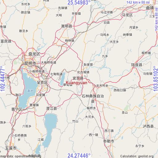
Kuangyuan GPS coordinates[2]
24° 54' 49.644" North, 103° 8' 52.404" East
| Map corner | latitude | longitude |
|---|---|---|
| Upper-left | 25.54983°, | 102.44477° |
| Center: | 24.91379°, | 103.14789° |
| Lower-right: | 24.27446°, | 103.85102° |
| Map W x H: | 141.8×141.8 km | = 88.1×88.1mi |
| max Lat: | 53.31946° ⇑86.8% North |
| Kuangyuan: | 24.91379° |
| min Lat: | ⇓13.2% South 18.22056° |
| min Long | Kuangyuan | max Long |
| 75.07348° | 103.14789° | 134.28917° |
| W 8.7%⇐ | ⇒91.3% E |
Elevation
Elevation of Kuangyuan is 1538 m = 5046 ft, and this is 1053.2 m = 3455 ft above average elevation for this country.
| Max E: |
5622 m = 18445 ft | 8.3% |
| Kuangyuan | 1538 m 5046 ft | |
| Avg. | 484.8 m = 1591 ft | |
Min E: |
-3 m = -10 ft | 91.7% |
See also: China elevation on elevation.city.
Geographical zone
Kuangyuan is located in North temperate zone (between Tropic of Cancer and the Arctic Circle). Distance of this Northern Tropic circle is 164.2 km =102 mi to South.| Distance of | km | miles | from Kuangyuan |
|---|---|---|---|
| North Pole | 7236.9 | 4496.8 | to North |
| Arctic Circle | 4631 | 2877.6 | to North |
| Tropic Cancer | 164.2 | 102 | to South |
| Equator | 2770.2 | 1721.3 | to South |


Nearby cities:
15 places around Kuangyuan: (largest is in red/bold)
• Beidacun Xiaozhai
22.3 km =13.9 mi,  106°
106°
• Beigucheng
8.6 km =5.3 mi,  23°
23°
• Caodianjie
10.8 km =6.7 mi,  244°
244°
• Dake
34.4 km =21.4 mi,  164°
164°
• Goujie
13.9 km =8.6 mi,  182°
182°
• Jiulong
29.8 km =18.5 mi,  214°
214°
• Lufu
20.9 km =13 mi,  144°
144°
• Majie
27.7 km =17.2 mi, 156°
• Nanyang
7.5 km =4.7 mi,  190°
190°
• Qidian
20.9 km =13 mi,  284°
284°
• Shilin
21.4 km =13.3 mi,  119°
119°
• Suyang
0.9 km =0.6 mi,  293°
293°
• Tangchijie
12.7 km =7.9 mi, 294°
• Wujiaying
30.8 km =19.1 mi,  261°
261°
• Yangzongnan Hengjie
20.7 km =12.9 mi, 240°
Sources, notices
• [Note1] Compared only with cities in China existing in our database
• [Src1] Map data: © OpenStreetMap contributors (CC-BY-SA)
• [Src2] Other city data from geonames.org with taken over terms of usage.
• [Src3] Geographical zone / Annual Mean Temperature by Robert A. Rohde @ Wikipedia
