Beigucheng geodata
Beigucheng (Yunnan) is a seat of a fourth-order administrative division; located in China in Asia/Shanghai (GMT+8) time zone. In our database, there are 1268 cities with bigger population. Compared to other cities in China, 86.4% of cities are located further ↑North; 91.3% of cities are located further →East and 91.6% of cities have lower elevation than Beigucheng. Note1


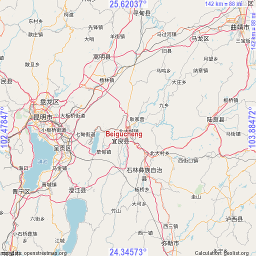
Beigucheng GPS coordinates[2]
24° 59' 4.92" North, 103° 10' 53.724" East
| Map corner | latitude | longitude |
|---|---|---|
| Upper-left | 25.62037°, | 102.47847° |
| Center: | 24.9847°, | 103.18159° |
| Lower-right: | 24.34573°, | 103.88472° |
| Map W x H: | 141.7×141.7 km | = 88×88mi |
| max Lat: | 53.31946° ⇑86.4% North |
| Beigucheng: | 24.9847° |
| min Lat: | ⇓13.6% South 18.22056° |
| min Long | Beigucheng | max Long |
| 75.07348° | 103.18159° | 134.28917° |
| W 8.7%⇐ | ⇒91.3% E |
Elevation
Elevation of Beigucheng is 1534 m = 5033 ft, and this is 1049.2 m = 3442 ft above average elevation for this country.
| Max E: |
5622 m = 18445 ft | 8.4% |
| Beigucheng | 1534 m 5033 ft | |
| Avg. | 484.8 m = 1591 ft | |
Min E: |
-3 m = -10 ft | 91.6% |
See also: China elevation on elevation.city.
Geographical zone
Beigucheng is located in North temperate zone (between Tropic of Cancer and the Arctic Circle). Distance of this Northern Tropic circle is 172.1 km =106.9 mi to South.| Distance of | km | miles | from Beigucheng |
|---|---|---|---|
| North Pole | 7229 | 4491.9 | to North |
| Arctic Circle | 4623.1 | 2872.7 | to North |
| Tropic Cancer | 172.1 | 106.9 | to South |
| Equator | 2778 | 1726.2 | to South |


Nearby cities:
15 places around Beigucheng: (largest is in red/bold)
• Beidacun Xiaozhai
22.8 km =14.2 mi,  128°
128°
• Caodianjie
18.2 km =11.3 mi,  226°
226°
• Goujie
22.1 km =13.7 mi,  190°
190°
• Jiulong
38.2 km =23.7 mi,  212°
212°
• Kuangyuan
8.6 km =5.3 mi,  203°
203°
• Lufu
26.4 km =16.4 mi,  161°
161°
• Majie
34.1 km =21.2 mi,  166°
166°
• Nanyang
15.9 km =9.9 mi, 197°
• Qidian
23.8 km =14.8 mi,  263°
263°
• Shilin
23.9 km =14.9 mi,  140°
140°
• Suyang
8.6 km =5.3 mi, 209°
• Tangchijie
15.1 km =9.4 mi, 260°
• Weize
38.2 km =23.7 mi, 143°
• Wujiaying
36 km =22.4 mi,  250°
250°
• Yangzongnan Hengjie
28 km =17.4 mi, 229°
Sources, notices
• [Note1] Compared only with cities in China existing in our database
• [Src1] Map data: © OpenStreetMap contributors (CC-BY-SA)
• [Src2] Other city data from geonames.org with taken over terms of usage.
• [Src3] Geographical zone / Annual Mean Temperature by Robert A. Rohde @ Wikipedia
