Shuangxiqiao geodata
Shuangxiqiao (Hubei) is a seat of a fourth-order administrative division; located in China in Asia/Shanghai (GMT+8) time zone. In our database, there are 1268 cities with bigger population. Compared to other cities in China, 54.7% of cities are located further ↑North; 51.5% of cities are located further ←West and 66.6% of cities have higher elevation than Shuangxiqiao. Note1


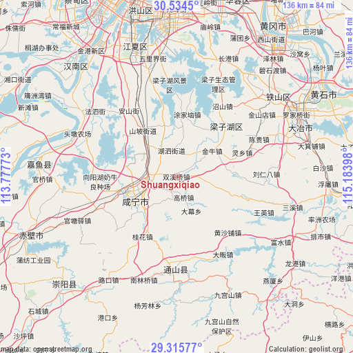
Shuangxiqiao GPS coordinates[2]
29° 55' 37.2" North, 114° 28' 51.06" East
| Map corner | latitude | longitude |
|---|---|---|
| Upper-left | 30.5345°, | 113.77773° |
| Center: | 29.927°, | 114.48085° |
| Lower-right: | 29.31577°, | 115.18398° |
| Map W x H: | 135.5×135.5 km | = 84.2×84.2mi |
| max Lat: | 53.31946° ⇑54.7% North |
| Shuangxiqiao: | 29.927° |
| min Lat: | ⇓45.3% South 18.22056° |
| min Long | Shuangxiqiao | max Long |
| 75.07348° | 114.48085° | 134.28917° |
| W 51.5%⇐ | ⇒48.5% E |
Elevation
Elevation of Shuangxiqiao is 66 m = 217 ft, and this is 418.8 m = 1374 ft below average elevation for this country.
| Max E: |
5622 m = 18445 ft | 66.6% |
| Avg. | 484.8 m = 1591 ft | |
| Shuangxiqiao | 66 m = 217 ft | |
Min E: |
-3 m = -10 ft | 33.4% |
See also: China elevation on elevation.city.
Geographical zone
Shuangxiqiao is located in North temperate zone (between Tropic of Cancer and the Arctic Circle). Distance of this Northern Tropic circle is 721.7 km =448.4 mi to South.| Distance of | km | miles | from Shuangxiqiao |
|---|---|---|---|
| North Pole | 6679.5 | 4150.4 | to North |
| Arctic Circle | 4073.6 | 2531.2 | to North |
| Tropic Cancer | 721.7 | 448.4 | to South |
| Equator | 3327.6 | 2067.7 | to South |


Nearby cities:
15 places around Shuangxiqiao: (largest is in red/bold)
• Chengui
33.6 km =20.9 mi,  66°
66°
• Damu
14.3 km =8.9 mi,  156°
156°
• Fushan
17.7 km =11 mi,  247°
247°
• Gaoqiao
8.4 km =5.2 mi, 158°
• Guanbuqiao
15.9 km =9.9 mi,  259°
259°
• Guihua
26.7 km =16.6 mi,  209°
209°
• Henggouqiao
12 km =7.5 mi,  272°
272°
• Huangshapu
28.1 km =17.5 mi,  136°
136°
• Liurenba
33.7 km =20.9 mi,  87°
87°
• Maqiao
18 km =11.2 mi,  222°
222°
• Mingshan
30.7 km =19.1 mi,  61°
61°
• Tingsiqiao
32.7 km =20.3 mi, 247°
• Tongyang
30.6 km =19 mi, 158°
• Xiangyanghu
30.6 km =19 mi, 265°
• Xianning
17.9 km =11.1 mi,  238°
238°
Sources, notices
• [Note1] Compared only with cities in China existing in our database
• [Src1] Map data: © OpenStreetMap contributors (CC-BY-SA)
• [Src2] Other city data from geonames.org with taken over terms of usage.
• [Src3] Geographical zone / Annual Mean Temperature by Robert A. Rohde @ Wikipedia
