Shangbahe geodata
Shangbahe (Hubei) is a seat of a fourth-order administrative division; located in China in Asia/Shanghai (GMT+8) time zone. In our database, there are 1268 cities with bigger population. Compared to other cities in China, 51.6% of cities are located further ↓South; 54.9% of cities are located further ←West and 73% of cities have higher elevation than Shangbahe. Note1


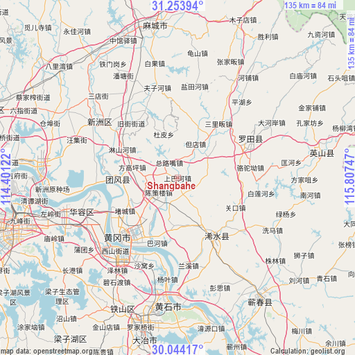
Shangbahe GPS coordinates[2]
30° 39' 3.42" North, 115° 6' 15.624" East
| Map corner | latitude | longitude |
|---|---|---|
| Upper-left | 31.25394°, | 114.40122° |
| Center: | 30.65095°, | 115.10434° |
| Lower-right: | 30.04417°, | 115.80747° |
| Map W x H: | 134.5×134.5 km | = 83.6×83.6mi |
| max Lat: | 53.31946° ⇑48.4% North |
| Shangbahe: | 30.65095° |
| min Lat: | ⇓51.6% South 18.22056° |
| min Long | Shangbahe | max Long |
| 75.07348° | 115.10434° | 134.28917° |
| W 54.9%⇐ | ⇒45.1% E |
Elevation
Elevation of Shangbahe is 42 m = 138 ft, and this is 442.8 m = 1453 ft below average elevation for this country.
| Max E: |
5622 m = 18445 ft | 73% |
| Avg. | 484.8 m = 1591 ft | |
| Shangbahe | 42 m = 138 ft | |
Min E: |
-3 m = -10 ft | 27% |
See also: China elevation on elevation.city.
Geographical zone
Shangbahe is located in North temperate zone (between Tropic of Cancer and the Arctic Circle). Distance of this Northern Tropic circle is 802.1 km =498.4 mi to South.| Distance of | km | miles | from Shangbahe |
|---|---|---|---|
| North Pole | 6599 | 4100.4 | to North |
| Arctic Circle | 3993.1 | 2481.2 | to North |
| Tropic Cancer | 802.1 | 498.4 | to South |
| Equator | 3408.1 | 2117.7 | to South |


Nearby cities:
15 places around Shangbahe: (largest is in red/bold)
• Chencelou
8.1 km =5 mi,  223°
223°
• Dandian
14.8 km =9.2 mi,  28°
28°
• Ducheng
23.2 km =14.4 mi,  239°
239°
• Dupi
16.9 km =10.5 mi,  342°
342°
• Fanggaoping
17.4 km =10.8 mi,  282°
282°
• Huilongshan
12.7 km =7.9 mi,  253°
253°
• Jiamiao
16.3 km =10.1 mi,  352°
352°
• Linshanhe
23.4 km =14.5 mi,  295°
295°
• Macaomiao
8.3 km =5.2 mi,  274°
274°
• Taodian
18.2 km =11.3 mi,  227°
227°
• Tuanbei
14.6 km =9.1 mi,  53°
53°
• Tuanfeng
19.3 km =12 mi,  291°
291°
• Wanggang
7.3 km =4.5 mi,  115°
115°
• Zhuwa
6.3 km =3.9 mi,  169°
169°
• Zongluzui
6.6 km =4.1 mi,  320°
320°
Sources, notices
• [Note1] Compared only with cities in China existing in our database
• [Src1] Map data: © OpenStreetMap contributors (CC-BY-SA)
• [Src2] Other city data from geonames.org with taken over terms of usage.
• [Src3] Geographical zone / Annual Mean Temperature by Robert A. Rohde @ Wikipedia
