Qingquan geodata
Qingquan (Gansu) is a seat of a third-order administrative division; located in China in Asia/Shanghai (GMT+8) time zone. In our database, there are 1268 cities with bigger population. Compared to other cities in China, 82.3% of cities are located further ↓South; 93.7% of cities are located further →East and 93.4% of cities have lower elevation than Qingquan. Note1


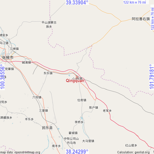
Qingquan GPS coordinates[2]
38° 47' 35.232" North, 101° 5' 19.248" East
| Map corner | latitude | longitude |
|---|---|---|
| Upper-left | 39.33904°, | 100.38556° |
| Center: | 38.79312°, | 101.08868° |
| Lower-right: | 38.24299°, | 101.79181° |
| Map W x H: | 121.9×121.9 km | = 75.7×75.7mi |
| max Lat: | 53.31946° ⇑17.7% North |
| Qingquan: | 38.79312° |
| min Lat: | ⇓82.3% South 18.22056° |
| min Long | Qingquan | max Long |
| 75.07348° | 101.08868° | 134.28917° |
| W 6.3%⇐ | ⇒93.7% E |
Elevation
Elevation of Qingquan is 1773 m = 5817 ft, and this is 1288.2 m = 4226 ft above average elevation for this country.
| Max E: |
5622 m = 18445 ft | 6.6% |
| Qingquan | 1773 m 5817 ft | |
| Avg. | 484.8 m = 1591 ft | |
Min E: |
-3 m = -10 ft | 93.4% |
See also: China elevation on elevation.city.
Geographical zone
Qingquan is located in North temperate zone (between Tropic of Cancer and the Arctic Circle). Distance of this Northern Tropic circle is 1707.5 km =1061 mi to South.| Distance of | km | miles | from Qingquan |
|---|---|---|---|
| North Pole | 5693.7 | 3537.9 | to North |
| Arctic Circle | 3087.8 | 1918.7 | to North |
| Tropic Cancer | 1707.5 | 1061 | to South |
| Equator | 4313.4 | 2680.2 | to South |


Nearby cities:
15 places around Qingquan: (largest is in red/bold)
• Ailibugai
42.2 km =26.2 mi,  78°
78°
• Damaying
48.4 km =30.1 mi,  168°
168°
• Dongle
25.5 km =15.8 mi,  278°
278°
• Hongshui
48.4 km =30.1 mi,  212°
212°
• Hongsihu
13.4 km =8.3 mi,  31°
31°
• Huazhaizi
34.4 km =21.4 mi,  161°
161°
• Huocheng
43.5 km =27 mi,  183°
183°
• Liuba
35.9 km =22.3 mi,  243°
243°
• Nanfeng
56.2 km =34.9 mi,  198°
198°
• Pingshanhu
46.9 km =29.1 mi,  331°
331°
• Sanbao
37.5 km =23.3 mi,  226°
226°
• Shunhua
48.6 km =30.2 mi,  222°
222°
• Weiqi
17.8 km =11.1 mi, 176°
• Xintian
55.3 km =34.4 mi, 238°
• Yonggu
47.4 km =29.5 mi,  194°
194°
Sources, notices
• [Note1] Compared only with cities in China existing in our database
• [Src1] Map data: © OpenStreetMap contributors (CC-BY-SA)
• [Src2] Other city data from geonames.org with taken over terms of usage.
• [Src3] Geographical zone / Annual Mean Temperature by Robert A. Rohde @ Wikipedia
