Hongshui geodata
Hongshui (Gansu) is a seat of a third-order administrative division; located in China in Asia/Shanghai (GMT+8) time zone. In our database, there are 1268 cities with bigger population. Compared to other cities in China, 81.7% of cities are located further ↓South; 93.9% of cities are located further →East and 95.5% of cities have lower elevation than Hongshui. Note1


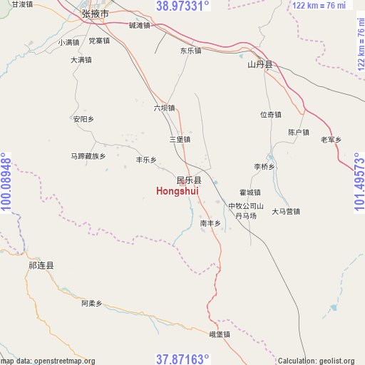
Hongshui GPS coordinates[2]
38° 25' 28.452" North, 100° 47' 33.36" East
| Map corner | latitude | longitude |
|---|---|---|
| Upper-left | 38.97331°, | 100.08948° |
| Center: | 38.42457°, | 100.7926° |
| Lower-right: | 37.87163°, | 101.49573° |
| Map W x H: | 122.5×122.5 km | = 76.1×76.1mi |
| max Lat: | 53.31946° ⇑18.3% North |
| Hongshui: | 38.42457° |
| min Lat: | ⇓81.7% South 18.22056° |
| min Long | Hongshui | max Long |
| 75.07348° | 100.7926° | 134.28917° |
| W 6.1%⇐ | ⇒93.9% E |
Elevation
Elevation of Hongshui is 2316 m = 7598 ft, and this is 1831.2 m = 6008 ft above average elevation for this country.
| Max E: |
5622 m = 18445 ft | 4.5% |
| Hongshui | 2316 m 7598 ft | |
| Avg. | 484.8 m = 1591 ft | |
Min E: |
-3 m = -10 ft | 95.5% |
See also: China elevation on elevation.city.
Geographical zone
Hongshui is located in North temperate zone (between Tropic of Cancer and the Arctic Circle). Distance of this Northern Tropic circle is 1666.5 km =1035.5 mi to South.| Distance of | km | miles | from Hongshui |
|---|---|---|---|
| North Pole | 5734.7 | 3563.4 | to North |
| Arctic Circle | 3128.8 | 1944.1 | to North |
| Tropic Cancer | 1666.5 | 1035.5 | to South |
| Equator | 4272.4 | 2654.7 | to South |


Nearby cities:
15 places around Hongshui: (largest is in red/bold)
• Damaying
36.1 km =22.4 mi,  100°
100°
• Dongle
44.8 km =27.8 mi,  0°
0°
• Hongtu
52.2 km =32.4 mi,  166°
166°
• Huazhai
43.7 km =27.2 mi,  300°
300°
• Huazhaizi
37.9 km =23.5 mi,  77°
77°
• Huocheng
23 km =14.3 mi, 95°
• Liuba
25.8 km =16 mi,  345°
345°
• Nanfeng
14.6 km =9.1 mi,  147°
147°
• Nangu
31.6 km =19.6 mi,  293°
293°
• Qingquan
48.4 km =30.1 mi,  32°
32°
• Sanbao
15 km =9.3 mi, 354°
• Shunhua
8.4 km =5.2 mi,  305°
305°
• Weiqi
35.4 km =22 mi,  49°
49°
• Xintian
24.4 km =15.2 mi, 298°
• Yonggu
14.6 km =9.1 mi,  109°
109°
Sources, notices
• [Note1] Compared only with cities in China existing in our database
• [Src1] Map data: © OpenStreetMap contributors (CC-BY-SA)
• [Src2] Other city data from geonames.org with taken over terms of usage.
• [Src3] Geographical zone / Annual Mean Temperature by Robert A. Rohde @ Wikipedia
