Qinghua geodata
Qinghua (Shaanxi) is a seat of a fourth-order administrative division; located in China in Asia/Shanghai (GMT+8) time zone. In our database, there are 1268 cities with bigger population. Compared to other cities in China, 71% of cities are located further ↓South; 80.5% of cities are located further →East and 72.1% of cities have lower elevation than Qinghua. Note1


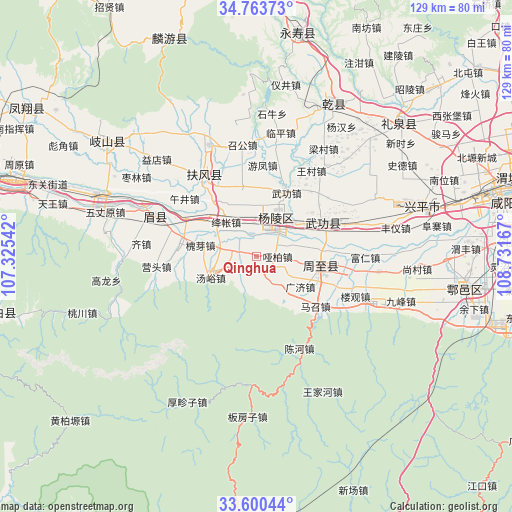
Qinghua GPS coordinates[2]
34° 11' 2.724" North, 108° 1' 42.744" East
| Map corner | latitude | longitude |
|---|---|---|
| Upper-left | 34.76373°, | 107.32542° |
| Center: | 34.18409°, | 108.02854° |
| Lower-right: | 33.60044°, | 108.73167° |
| Map W x H: | 129.3×129.3 km | = 80.3×80.3mi |
| max Lat: | 53.31946° ⇑29% North |
| Qinghua: | 34.18409° |
| min Lat: | ⇓71% South 18.22056° |
| min Long | Qinghua | max Long |
| 75.07348° | 108.02854° | 134.28917° |
| W 19.5%⇐ | ⇒80.5% E |
Elevation
Elevation of Qinghua is 454 m = 1490 ft, and this is 30.8 m = 101 ft below average elevation for this country.
| Max E: |
5622 m = 18445 ft | 27.9% |
| Avg. | 484.8 m = 1591 ft | |
| Qinghua | 454 m = 1490 ft | |
Min E: |
-3 m = -10 ft | 72.1% |
See also: China elevation on elevation.city.
Geographical zone
Qinghua is located in North temperate zone (between Tropic of Cancer and the Arctic Circle). Distance of this Northern Tropic circle is 1195 km =742.5 mi to South.| Distance of | km | miles | from Qinghua |
|---|---|---|---|
| North Pole | 6206.1 | 3856.3 | to North |
| Arctic Circle | 3600.3 | 2237.1 | to North |
| Tropic Cancer | 1195 | 742.5 | to South |
| Equator | 3800.9 | 2361.8 | to South |


Nearby cities:
15 places around Qinghua: (largest is in red/bold)
• Dazhuang
14.5 km =9 mi,  57°
57°
• Duanjia
18 km =11.2 mi,  321°
321°
• Erqu
16.7 km =10.4 mi,  102°
102°
• Guangji
13.2 km =8.2 mi,  123°
123°
• Hengqu
6.5 km =4 mi,  282°
282°
• Houjia
14.2 km =8.8 mi, 98°
• Huaiya
14.6 km =9.1 mi, 280°
• Jiangzhang
12.9 km =8 mi,  310°
310°
• Shangsong
16.7 km =10.4 mi,  302°
302°
• Tangyu
14.8 km =9.2 mi,  254°
254°
• Wugong
17.6 km =10.9 mi,  24°
24°
• Wuquan
13.3 km =8.3 mi,  345°
345°
• Yabai
5.4 km =3.4 mi, 95°
• Yangling
10.8 km =6.7 mi,  25°
25°
• Zhuyu
5.5 km =3.4 mi,  169°
169°
Sources, notices
• [Note1] Compared only with cities in China existing in our database
• [Src1] Map data: © OpenStreetMap contributors (CC-BY-SA)
• [Src2] Other city data from geonames.org with taken over terms of usage.
• [Src3] Geographical zone / Annual Mean Temperature by Robert A. Rohde @ Wikipedia
