Guangji geodata
Guangji (Shaanxi) is a seat of a fourth-order administrative division; located in China in Asia/Shanghai (GMT+8) time zone. In our database, there are 1268 cities with bigger population. Compared to other cities in China, 70.7% of cities are located further ↓South; 80% of cities are located further →East and 73.7% of cities have lower elevation than Guangji. Note1


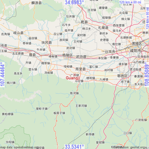
Guangji GPS coordinates[2]
34° 7' 5.52" North, 108° 8' 51.936" East
| Map corner | latitude | longitude |
|---|---|---|
| Upper-left | 34.6983°, | 107.44464° |
| Center: | 34.1182°, | 108.14776° |
| Lower-right: | 33.5341°, | 108.85089° |
| Map W x H: | 129.4×129.4 km | = 80.4×80.4mi |
| max Lat: | 53.31946° ⇑29.3% North |
| Guangji: | 34.1182° |
| min Lat: | ⇓70.7% South 18.22056° |
| min Long | Guangji | max Long |
| 75.07348° | 108.14776° | 134.28917° |
| W 20%⇐ | ⇒80% E |
Elevation
Elevation of Guangji is 492 m = 1614 ft, and this is 7.2 m = 24 ft above average elevation for this country.
| Max E: |
5622 m = 18445 ft | 26.3% |
| Guangji | 492 m 1614 ft | |
| Avg. | 484.8 m = 1591 ft | |
Min E: |
-3 m = -10 ft | 73.7% |
See also: China elevation on elevation.city.
Geographical zone
Guangji is located in North temperate zone (between Tropic of Cancer and the Arctic Circle). Distance of this Northern Tropic circle is 1187.7 km =738 mi to South.| Distance of | km | miles | from Guangji |
|---|---|---|---|
| North Pole | 6213.5 | 3860.9 | to North |
| Arctic Circle | 3607.6 | 2241.7 | to North |
| Tropic Cancer | 1187.7 | 738 | to South |
| Equator | 3793.6 | 2357.2 | to South |


Nearby cities:
15 places around Guangji: (largest is in red/bold)
• Dazhuang
15.1 km =9.4 mi,  5°
5°
• Erqu
6.6 km =4.1 mi,  54°
54°
• Hengqu
19.3 km =12 mi,  296°
296°
• Houjia
6 km =3.7 mi,  30°
30°
• Jixian
23.3 km =14.5 mi,  98°
98°
• Louguan
14.2 km =8.8 mi, 101°
• Mazhaozhen
6.6 km =4.1 mi,  143°
143°
• Pujijie
15.6 km =9.7 mi, 34°
• Qinghua
13.2 km =8.2 mi, 303°
• Wugong
16.5 km =10.3 mi,  19°
19°
• Xiaocun
19.3 km =12 mi, 32°
• Yabai
8.8 km =5.5 mi,  320°
320°
• Yangling
18.2 km =11.3 mi,  339°
339°
• Zhongnan
19.8 km =12.3 mi,  80°
80°
• Zhuyu
10.2 km =6.3 mi,  280°
280°
Sources, notices
• [Note1] Compared only with cities in China existing in our database
• [Src1] Map data: © OpenStreetMap contributors (CC-BY-SA)
• [Src2] Other city data from geonames.org with taken over terms of usage.
• [Src3] Geographical zone / Annual Mean Temperature by Robert A. Rohde @ Wikipedia
