Qiaotou geodata
Qiaotou (Gansu) is a seat of a fourth-order administrative division; located in China in Asia/Shanghai (GMT+8) time zone. In our database, there are 1268 cities with bigger population. Compared to other cities in China, 69% of cities are located further ↓South; 89.3% of cities are located further →East and 92.1% of cities have lower elevation than Qiaotou. Note1


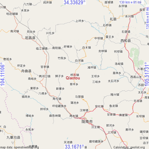
Qiaotou GPS coordinates[2]
33° 45' 13.284" North, 104° 48' 51.048" East
| Map corner | latitude | longitude |
|---|---|---|
| Upper-left | 34.33629°, | 104.11106° |
| Center: | 33.75369°, | 104.81418° |
| Lower-right: | 33.1671°, | 105.51731° |
| Map W x H: | 130×130 km | = 80.8×80.8mi |
| max Lat: | 53.31946° ⇑31% North |
| Qiaotou: | 33.75369° |
| min Lat: | ⇓69% South 18.22056° |
| min Long | Qiaotou | max Long |
| 75.07348° | 104.81418° | 134.28917° |
| W 10.7%⇐ | ⇒89.3% E |
Elevation
Elevation of Qiaotou is 1591 m = 5220 ft, and this is 1106.2 m = 3629 ft above average elevation for this country.
| Max E: |
5622 m = 18445 ft | 7.9% |
| Qiaotou | 1591 m 5220 ft | |
| Avg. | 484.8 m = 1591 ft | |
Min E: |
-3 m = -10 ft | 92.1% |
See also: China elevation on elevation.city.
Geographical zone
Qiaotou is located in North temperate zone (between Tropic of Cancer and the Arctic Circle). Distance of this Northern Tropic circle is 1147.1 km =712.8 mi to South.| Distance of | km | miles | from Qiaotou |
|---|---|---|---|
| North Pole | 6254 | 3886.1 | to North |
| Arctic Circle | 3648.1 | 2266.8 | to North |
| Tropic Cancer | 1147.1 | 712.8 | to South |
| Equator | 3753.1 | 2332.1 | to South |


Nearby cities:
15 places around Qiaotou: (largest is in red/bold)
• Baihe
13.4 km =8.3 mi,  15°
15°
• Caoping
8.3 km =5.2 mi,  183°
183°
• Chiba
12.3 km =7.6 mi,  193°
193°
• Hanyuan
25.2 km =15.7 mi,  332°
332°
• Jinchang
17 km =10.6 mi,  153°
153°
• Leiba
21.1 km =13.1 mi,  78°
78°
• Maying
17.7 km =11 mi,  170°
170°
• Puchi
24.4 km =15.2 mi, 180°
• Quanshui
11 km =6.8 mi,  346°
346°
• Sanyu
20 km =12.4 mi,  107°
107°
• Shizi
12.4 km =7.7 mi,  265°
265°
• Tanping
16.2 km =10.1 mi,  66°
66°
• Wangba
18.2 km =11.3 mi,  93°
93°
• Xinzhai
17.2 km =10.7 mi,  224°
224°
• Zhuyuan
17.9 km =11.1 mi, 325°
Sources, notices
• [Note1] Compared only with cities in China existing in our database
• [Src1] Map data: © OpenStreetMap contributors (CC-BY-SA)
• [Src2] Other city data from geonames.org with taken over terms of usage.
• [Src3] Geographical zone / Annual Mean Temperature by Robert A. Rohde @ Wikipedia
